
- Home
- Forecast
- Radar
- Maps
- WX-Data
- WX-Misc.
- Astronomy
- Fire
- About
- Links
 Air Quality
Radar |
") |
| Advisories / Alerts |
| Severe Wx Summary! | ||||||
 |
||||||
|
||||||
|
||||||
 |
||||||
| Tue, Apr 23, 2024 - 12:11pm | ||||||
|
|
|
|
|
|
| Today's Forecast Map |
| Color Satellite |
| Info Links | |
| Live NOAA Weather Radio |
 |
|
|

| La Niña / El Niño Index |
| Past 48 months graph |
| Past 10 Years graph |
| 1950 to Present graph |
| 1950 to Present Text |
| Synopsis and more |
| Water Temp Map |
|
")
| Free Web Stickers |
| Forecast Search |


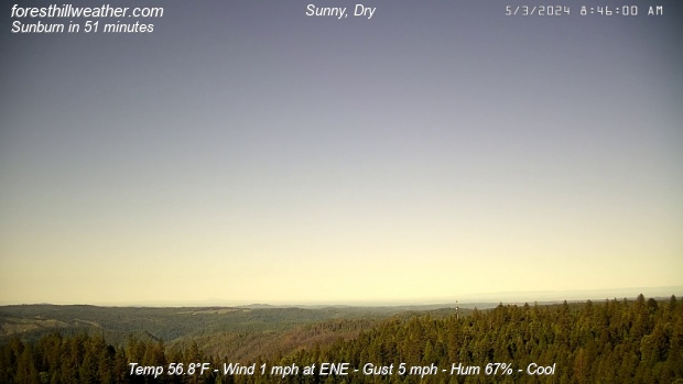
| Weather Conditions Sunny, Dry Visibility: 10 miles |
|
|
This Icon is a Combination of Blue Canyon Airport and Data From foresthillweather.com |
|
Visibility: 10 miles
Summary / Temperature ![]()

59.3°F

")
60.9°F

64.1°F/ 17.8°C
Temp Rate:
24/hr Difference:
Avg Running Temp:
Todays High:
Todays Low:
Y-days High:
Y-days Low:
Todays WChill:
Y-days WChill:
Evapotranspiration:
+3.1°F/hr ![]()
-14.3°F ![]()
59.4°F
61.8°F 11:41am
48.0°F 7:29am
81.3°F 2:56pm
56.8°F 6:50am
43.7°F 7:40am
53.2°F 6:56am
0.043 in
Pool water Temperature ![]()
Temperature:
Pool Temp VRS Out Temp:
Avg Running Temp:
Todays High:
Todays Low:
Y-days High:
Y-days Low:
59.0°F
-2.6°F ![]()
59.0°F
59.0°F 12:00am
58.0°F 9:19am
59.0°F 1:26pm
57.0°F 9:25am
24hr Pool Temperature Graph 10 day Pool Temperature Graph Wind ![]()

1.0 mph
Gusting to
12.0 mph

226° SW

Avg speed:
Wind Run:
Peak Gust:
4.5 mph ![]()
17.0 miles
12 mph 12:17pm
Almanac ![]()

Illuminated 14 days in cycle
Moonrise:
Moonset:
Sunrise:
Sunset:
Solar Noon:
7:55pm
5:58am
6:12am
7:46pm
1:02pm
Solar Radiation ![]()
912 W/m2 (85%)
928 W/m2@12:19pm

Rain
Rain Today:
Rain Rate (/hr):
Rain last hour:
Rain Yesterday:
This Month:
Season Total:
8 Days Since Last Rain Day
0.00 in
0.000 in
0.00 in
0.00 in
1.32 in
45.75 in
Updated Time
Updated: 4/23/24 12:20pm
(Updated sec ago)
Humidity & Barometer
Humidity:
Wetbulb:
Dew Point:
Barometer:
67% ![]()
55.4°F
50.5°F ![]()
29.920 inHg ![]()
| Northern Calif Preparedness |
|
| Fire Level |
|
UV Index ![]()
7.5 High
7.5 High
Today Sunny |
Tonight Mostly Clear |
Wednesday Mostly Sunny |
Wednesday Night  Partly Cloudy |
Thursday Mostly Sunny |
Thursday Night  Chance Rain Showers |
| Hi 65 °F ↓ | Lo 46 °F | Hi 63 °F ↓ | Lo 45 °F | Hi 58 °F | Lo 46 °F |


Foresthill Probe 2 Stats ![]()
Foresthill Probe 2: is located on Thomas Street
at 3000 feet. The main Foresthill Weather site
is located on Melody ln at the 2860 foot elevation
+2.6°F
70%

| Updated: 23/04/24 - 12:19:10 | |
| Todays High: | 63.1°F 11:41 |
| Todays Low: | 47.9°F 07:23 |
| Rain Today: | 0.00 in |
| Season Total: | 43.60 in |
Foresthill Wx: Monthly,Yearly, Highs and Lows ![]()
|
||||||||||
|
||||||||||
|
||||||||||
|
||||||||||
|
||||||||||
|
||||||||||
|
||||||||||
|
||||||||||
|
||||||||||

")
")
")
")
")
; "Satellite Imagery Sacramento,CA. (click to enlarge)")
| NWS Weather Forecast - Summary | ||||||||||||||||
|
||||||||||||||||
| NWS Weather Forecast: Today and Tonight (Updated: Tue, 23-Apr-2024 5:21am PDT) | |||||
|
|
||||
| NWS Weather Forecast - Summary | ||||||||||||||||
|
||||||||||||||||
| Wunderground Forecast: Today and Tonight | |||||
|
|
||||
| Data Compliments of Weather Underground | |||||
| NOAA Local Storm Report | |||||
| Eldon ( More ) | |||||
| DATE 04/16/2024 |
TIME 3:18 PM |
COUNTY Wapello |
STATE IA |
GEOGRAPHIC 40.92N 92.22W |
SOURCE AWOS |
| Tstm Wnd Gst MEASURED AT 58 MPH | |||||
| NOAA Local Storm Report | |||||
| 3 MILES EAST OF Palmer ( More ) | |||||
| DATE 04/16/2024 |
TIME 3:14 PM |
COUNTY Pocahontas |
STATE IA |
GEOGRAPHIC 42.63N 94.54W |
SOURCE Trained Spotter |
| Tornado | |||||
| spotter as well as law enforcement have confirmed a small rope tornado east of palmer. | |||||
| NOAA Local Storm Report | |||||
| 3 MILES SOUTH-SOUTHEAST OF Rolfe ( More ) | |||||
| DATE 04/16/2024 |
TIME 3:36 PM |
COUNTY Pocahontas |
STATE IA |
GEOGRAPHIC 42.77N 94.51W |
SOURCE Law Enforcement |
| Tornado | |||||
| officer located near the intersection of highways 3 and 15 looking to the northeast and viewing a tornado. | |||||
| NOAA Local Storm Report | |||||
| 1 MILE NORTH-NORTHEAST OF Chariton ( More ) | |||||
| DATE 04/16/2024 |
TIME 10:47 AM |
COUNTY Lucas |
STATE IA |
GEOGRAPHIC 41.02N 93.30W |
SOURCE Broadcast Media |
| Hail ESTIMATED AT 0.75 Inch | |||||
| local media relayed report of penny sized hail on ne side of chariton. Time estimated from radar. | |||||
| NOAA Local Storm Report | |||||
| 3 MILES NORTHWEST OF Buckeye ( More ) | |||||
| DATE 04/16/2024 |
TIME 12:35 PM |
COUNTY Hardin |
STATE IA |
GEOGRAPHIC 42.45N 93.41W |
SOURCE Emergency Mngr |
| Tstm Wnd Dmg | |||||
| livestock building sustained damage during structural repair. Time estimated by radar. | |||||
| NOAA Local Storm Report | |||||
| 1 MILE WEST-NORTHWEST OF Estherville ( More ) | |||||
| DATE 04/16/2024 |
TIME 5:49 PM |
COUNTY Emmet |
STATE IA |
GEOGRAPHIC 43.40N 94.85W |
SOURCE Trained Spotter |
| Hail ESTIMATED AT 1.00 Inch | |||||
| NOAA Local Storm Report | |||||
| Bloomfield ( More ) | |||||
| DATE 04/16/2024 |
TIME 12:08 PM |
COUNTY Davis |
STATE IA |
GEOGRAPHIC 40.75N 92.42W |
SOURCE Other Federal |
| Hail ESTIMATED AT 1.00 Inch | |||||
| delayed report. Time estimated from radar. Reported at post office. | |||||
| NOAA Local Storm Report | |||||
| 2 MILES NORTH-NORTHEAST OF Floris ( More ) | |||||
| DATE 04/16/2024 |
TIME 12:15 PM |
COUNTY Davis |
STATE IA |
GEOGRAPHIC 40.89N 92.32W |
SOURCE Public |
| Hail ESTIMATED AT 0.88 Inch | |||||
| NOAA Local Storm Report | |||||
| 4 MILES SOUTH OF Drakesville ( More ) | |||||
| DATE 04/16/2024 |
TIME 2:56 PM |
COUNTY Davis |
STATE IA |
GEOGRAPHIC 40.74N 92.50W |
SOURCE Public |
| Hail MEASURED AT 1.00 Inch | |||||
| report from mping: quarter (1. 00 in.). | |||||
| NOAA Local Storm Report | |||||
| 2 MILES WEST-NORTHWEST OF Dallas Center ( More ) | |||||
| DATE 04/16/2024 |
TIME 11:05 AM |
COUNTY Dallas |
STATE IA |
GEOGRAPHIC 41.70N 94.00W |
SOURCE Fire Dept/Rescue |
| Tornado | |||||
| damage to outbuilding. Time estimated from radar. | |||||
| NOAA Local Storm Report | |||||
| 2 MILES EAST OF Minburn ( More ) | |||||
| DATE 04/16/2024 |
TIME 11:10 AM |
COUNTY Dallas |
STATE IA |
GEOGRAPHIC 41.75N 93.99W |
SOURCE Amateur Radio |
| Tornado | |||||
| outbuilding sheet metal scattered in fields. | |||||
| NOAA Local Storm Report | |||||
| 5 MILES WEST-SOUTHWEST OF Knierim ( More ) | |||||
| DATE 04/16/2024 |
TIME 2:35 PM |
COUNTY Calhoun |
STATE IA |
GEOGRAPHIC 42.42N 94.53W |
SOURCE Trained Spotter |
| Tornado | |||||
| NOAA Local Storm Report | |||||
| 2 MILES SOUTH OF Manson ( More ) | |||||
| DATE 04/16/2024 |
TIME 2:59 PM |
COUNTY Calhoun |
STATE IA |
GEOGRAPHIC 42.50N 94.53W |
SOURCE Trained Spotter |
| Tornado | |||||
| NOAA Local Storm Report | |||||
| 5 MILES SOUTH-SOUTHEAST OF Dumont ( More ) | |||||
| DATE 04/16/2024 |
TIME 5:03 PM |
COUNTY Butler |
STATE IA |
GEOGRAPHIC 42.69N 92.92W |
SOURCE Trained Spotter |
| Rain ESTIMATED AT 1.50 Inch | |||||
| 1. 50 inch storm total rainfall. | |||||
| NOAA Local Storm Report | |||||
| 5 MILES SOUTH-SOUTHEAST OF Dumont ( More ) | |||||
| DATE 04/16/2024 |
TIME 5:03 PM |
COUNTY Butler |
STATE IA |
GEOGRAPHIC 42.69N 92.92W |
SOURCE Trained Spotter |
| Rain ESTIMATED AT 1.50 Inch | |||||
| 1. 50 inch storm total rainfall. | |||||
| NOAA Local Storm Report | |||||
| 5 MILES EAST OF Centerville ( More ) | |||||
| DATE 04/16/2024 |
TIME 2:41 PM |
COUNTY Appanoose |
STATE IA |
GEOGRAPHIC 40.72N 92.79W |
SOURCE Law Enforcement |
| Hail ESTIMATED AT 0.88 Inch | |||||
| earlier report. Time estimated by radar. | |||||
| How Close Are We To this Month's Temperature Record? Updated Tuesday, Apr 23, 2024- 12:15:01 PM Current Temperature: 61.6°F |
| April's High: Temperature Record 84.0°F - Set on Fri, Apr 28, 2023 - 2:09:11 PM We are currently 22.4°F |
| April's Low: Temperature Record 27.2°F - Set on Mon, Apr 3, 2023 - 7:16:06 AM We are currently 34.4°F |
| Records began on 03 November 2011 |
Weather History April 23, 2024
|


Ambient Weather VWS v14.00 Weather-Display (10.37S-(b58))
Virtual VP software Top Website Map Copyright © 2007 - 2024 Foresthillweather.com Never base important decisions on this or any weather information obtained from the Internet