
- Home
- Forecast
- Radar
- Maps
- WX-Data
- WX-Misc.
- Astronomy
- Fire
- About
- Links
 Air Quality
Radar |
") |
| Advisories / Alerts |
| Severe Wx Summary! | ||||||
 |
||||||
|
||||||
|
||||||
 |
||||||
| Wed, Apr 24, 2024 - 4:11am | ||||||
|
|
|
|
|
|
| Today's Forecast Map |
| Color Satellite |
| Info Links | |
| Live NOAA Weather Radio |
 |
|
|

| La Niña / El Niño Index |
| Past 48 months graph |
| Past 10 Years graph |
| 1950 to Present graph |
| 1950 to Present Text |
| Synopsis and more |
| Water Temp Map |
|
")
| Free Web Stickers |
| Forecast Search |


|
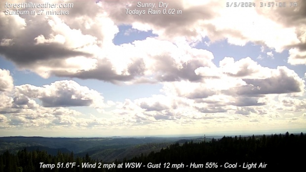
Weather Conditions Overcast , Dry Cloud ht: 500 ft Visibility: 10 miles |
|
This Icon is a Combination of Blue Canyon Airport and Data From foresthillweather.com |
|
Visibility: 10 miles Cloud ht: 500 ft
Summary / Temperature ![]()

45.6°F

")
46.9°F

46.9°F/ 8.3°C
Temp Rate:
24/hr Difference:
Avg Running Temp:
Todays High:
Todays Low:
Y-days High:
Y-days Low:
Todays WChill:
Y-days WChill:
Evapotranspiration:
-0.5°F/hr ![]()
-5.1°F ![]()
47.3°F
50.0°F 12:06am
46.9°F 4:02am
61.8°F 11:41am
48.0°F 7:29am
46.7°F 1:00am
43.7°F 7:40am
0.000 in
Pool water Temperature ![]()
Temperature:
Pool Temp VRS Out Temp:
Avg Running Temp:
Todays High:
Todays Low:
Y-days High:
Y-days Low:
59.0°F
+12.1°F ![]()
59.0°F
59.0°F 12:00am
59.0°F 12:00am
60.0°F 3:06pm
58.0°F 9:19am
24hr Pool Temperature Graph 10 day Pool Temperature Graph Wind ![]()

Calm
Gusting to
None

244°

Avg speed:
Wind Run:
Peak Gust:
Calm
1.0 miles
5 mph 12:53am
Almanac ![]()

Illuminated 15 days in cycle
Moonrise:
Moonset:
Sunrise:
Sunset:
Solar Noon:
8:59pm
6:23am
6:11am
7:47pm
1:01pm
Solar Radiation ![]()
Rain
Rain Today:
Rain Rate (/hr):
Rain last hour:
Rain Yesterday:
This Month:
Season Total:
9 Days Since Last Rain Day
0.00 in
0.000 in
0.00 in
0.00 in
1.32 in
45.75 in
Updated Time
Updated: 4/24/24 4:20am
(Updated sec ago)
Humidity & Barometer
Humidity:
Wetbulb:
Dew Point:
Barometer:
91% ![]()
45.6°F
44.4°F ![]()
30.037 inHg ![]()
| Northern Calif Preparedness |
|
| Fire Level |
|
UV Index ![]()
0.0 None
0.0 None
Overnight Mostly Cloudy |
Wednesday Partly Sunny |
Wednesday Night  Partly Cloudy |
Thursday Partly Sunny |
Thursday Night  Chance Rain Showers |
Friday Showers, |
| Lo 47 °F | Hi 62 °F ↓ | Lo 44 °F ↑ | Hi 59 °F | Lo 46 °F | Hi 56 °F |


Foresthill Probe 2 Stats ![]()
Foresthill Probe 2: is located on Thomas Street
at 3000 feet. The main Foresthill Weather site
is located on Melody ln at the 2860 foot elevation
-0.5°F
95%

| Updated: 24/04/24 - 04:18:21 | |
| Todays High: | 49.3°F 00:35 |
| Todays Low: | 45.9°F 03:52 |
| Rain Today: | 0.00 in |
| Season Total: | 43.60 in |
Foresthill Wx: Monthly,Yearly, Highs and Lows ![]()
|
||||||||||
|
||||||||||
|
||||||||||
|
||||||||||
|
||||||||||
|
||||||||||
|
||||||||||
|
||||||||||
|
||||||||||

")
")
")
")
")
; "Satellite Imagery Sacramento,CA. (click to enlarge)")
| NWS Weather Forecast - Summary | ||||||||||||||||
|
||||||||||||||||
| NWS Weather Forecast: Overnight and Wednesday (Updated: Wed, 24-Apr-2024 12:52am PDT) | |||||
|
|
||||
| NWS Weather Forecast - Summary | ||||||||||||||||
|
||||||||||||||||
| Wunderground Forecast: Today and Tonight | |||||
|
|
||||
| Data Compliments of Weather Underground | |||||
| NOAA Local Storm Report | |||||
| 8 MILES SOUTH OF Kirk ( More ) | |||||
| DATE 04/20/2024 |
TIME 6:17 AM |
COUNTY Kit Carson |
STATE CO |
GEOGRAPHIC 39.51N 102.59W |
SOURCE Public |
| Snow ESTIMATED AT 5.0 Inch | |||||
| social media report of around 5 inches of snow with a liquid equivalent of forty-six hundredths. | |||||
| NOAA Local Storm Report | |||||
| 13 MILES SOUTHWEST OF Joes ( More ) | |||||
| DATE 04/20/2024 |
TIME 7:00 AM |
COUNTY Kit Carson |
STATE CO |
GEOGRAPHIC 39.49N 102.82W |
SOURCE Cocorahs |
| Snow MEASURED AT 4.5 Inch | |||||
| cocorahs station co-kc-50 liberty 15 sw measured 4. 5 inches of snow accumulation at 7 am mdt this morning (saturday april 20). This report reflects snow accumulation that occurred during the preceding 24 hours. | |||||
| NOAA Local Storm Report | |||||
| Kirk ( More ) | |||||
| DATE 04/20/2024 |
TIME 9:00 AM |
COUNTY Yuma |
STATE CO |
GEOGRAPHIC 39.62N 102.60W |
SOURCE Public |
| Snow ESTIMATED AT 4.0 Inch | |||||
| public report via social media of 4 inches of snow in kirk, co. | |||||
| NOAA Local Storm Report | |||||
| Idalia ( More ) | |||||
| DATE 04/20/2024 |
TIME 11:04 AM |
COUNTY Yuma |
STATE CO |
GEOGRAPHIC 39.70N 102.29W |
SOURCE Public |
| Snow ESTIMATED AT 4.0 Inch | |||||
| report via social media of 4 inches of snow on the southside of idalia. | |||||
| NOAA Local Storm Report | |||||
| 13 MILES NORTH-NORTHWEST OF Ruleton ( More ) | |||||
| DATE 04/20/2024 |
TIME 7:00 AM |
COUNTY Sherman |
STATE KS |
GEOGRAPHIC 39.52N 101.93W |
SOURCE Cocorahs |
| Snow MEASURED AT 3.5 Inch | |||||
| cocorahs station ks-sh-33 goodland 16. 6 nw measured 3. 5 inches of snow accumulation at 7 am mdt this morning (saturday april 20). This report reflects snow accumulation that occurred during the preceding 24 hours. | |||||
| NOAA Local Storm Report | |||||
| 3 MILES NORTH-NORTHEAST OF Vernon ( More ) | |||||
| DATE 04/20/2024 |
TIME 6:00 AM |
COUNTY Yuma |
STATE CO |
GEOGRAPHIC 39.98N 102.25W |
SOURCE Cocorahs |
| Snow MEASURED AT 3.1 Inch | |||||
| cocorahs station co-yu-62 vernon 3. 6 nne measured 3. 1 inches of snow accumulation at 6 am mdt this morning (saturday april 20). This report reflects snow accumulation that occurred during the preceding 24 hours. | |||||
| NOAA Local Storm Report | |||||
| 1 MILE EAST OF Burlington ( More ) | |||||
| DATE 04/20/2024 |
TIME 7:00 AM |
COUNTY Kit Carson |
STATE CO |
GEOGRAPHIC 39.31N 102.26W |
SOURCE CO-OP Observer |
| Snow MEASURED AT 2.3 Inch | |||||
| co-op observer station brlc2 burlington measured 2. 3 inches of snow accumulation at 7 am mdt this morning (saturday april 20). This report reflects snow accumulation that occurred during the preceding 24 hours. | |||||
| NOAA Local Storm Report | |||||
| 1 MILE NORTHEAST OF Goodland ( More ) | |||||
| DATE 04/20/2024 |
TIME 9:30 AM |
COUNTY Sherman |
STATE KS |
GEOGRAPHIC 39.35N 101.70W |
SOURCE NWS Employee |
| Snow MEASURED AT 2.0 Inch | |||||
| 2. 0 inches of snow accumulation measured in goodland, ks at 9:30 am mdt this morning (saturday april 20). This report reflects snow accumulation that occurred during the preceding 24 hours. | |||||
| NOAA Local Storm Report | |||||
| 1 MILE NORTH-NORTHEAST OF Goodland ( More ) | |||||
| DATE 04/20/2024 |
TIME 5:55 AM |
COUNTY Sherman |
STATE KS |
GEOGRAPHIC 39.37N 101.70W |
SOURCE Official NWS Obs |
| Snow MEASURED AT 1.7 Inch | |||||
| corrects previous snow report from 1 nne goodland. Nws goodland measured a snow depth of 1. 7 inches at 6 am mdt this morning (saturday april 20). | |||||
| NOAA Local Storm Report | |||||
| 7 MILES NORTHWEST OF Peconic ( More ) | |||||
| DATE 04/20/2024 |
TIME 6:03 AM |
COUNTY Kit Carson |
STATE CO |
GEOGRAPHIC 39.40N 102.22W |
SOURCE Public |
| Snow ESTIMATED AT 1.7 Inch | |||||
| social media report with picture of about 1. 7 inches of storm total snowfall. | |||||
| NOAA Local Storm Report | |||||
| 4 MILES NORTH-NORTHEAST OF Wray ( More ) | |||||
| DATE 04/20/2024 |
TIME 6:00 AM |
COUNTY Yuma |
STATE CO |
GEOGRAPHIC 40.14N 102.20W |
SOURCE Cocorahs |
| Snow MEASURED AT 1.0 Inch | |||||
| cocorahs station co-yu-68 wray 4. 2 nne measured 1 inch of snow accumulation at 6 am mdt this morning (saturday april 20). This report reflects snow accumulation that occurred during the preceding 24 hours. | |||||
| NOAA Local Storm Report | |||||
| Yuma ( More ) | |||||
| DATE 04/20/2024 |
TIME 7:00 AM |
COUNTY Yuma |
STATE CO |
GEOGRAPHIC 40.12N 102.72W |
SOURCE CO-OP Observer |
| Snow MEASURED AT 1.0 Inch | |||||
| co-op observer station yumc2 yuma measured 1 inch of snow accumulation at 7 am mdt this morning (saturday april 20). This report reflects snow accumulation that occurred during the preceding 24 hours. | |||||
| How Close Are We To this Month's Temperature Record? Updated Wednesday, Apr 24, 2024- 4:15:01 AM Current Temperature: 46.9°F |
| April's High: Temperature Record 84.0°F - Set on Fri, Apr 28, 2023 - 2:09:11 PM We are currently 37.1°F |
| April's Low: Temperature Record 27.2°F - Set on Mon, Apr 3, 2023 - 7:16:06 AM We are currently 19.7°F |
| Records began on 03 November 2011 |
Weather History April 24, 2024
|


Ambient Weather VWS v14.00 Weather-Display (10.37S-(b58))
Virtual VP software Top Website Map Copyright © 2007 - 2024 Foresthillweather.com Never base important decisions on this or any weather information obtained from the Internet