
- Home
- Forecast
- Radar
- Maps
- WX-Data
- WX-Misc.
- Astronomy
- Fire
- About
- Links
 Air Quality
Radar |
") |
| Advisories / Alerts |
| Severe Wx Summary! | ||||||||||
 |
||||||||||
|
||||||||||
|
||||||||||
 |
||||||||||
| Fri, Apr 26, 2024 - 9:11am | ||||||||||
|
|
|
|
|
|
| Today's Forecast Map |
| Color Satellite |
| Info Links | |
| Live NOAA Weather Radio |
 |
|
|

| La Niña / El Niño Index |
| Past 48 months graph |
| Past 10 Years graph |
| 1950 to Present graph |
| 1950 to Present Text |
| Synopsis and more |
| Water Temp Map |
|
")
| Free Web Stickers |
| Forecast Search |


|
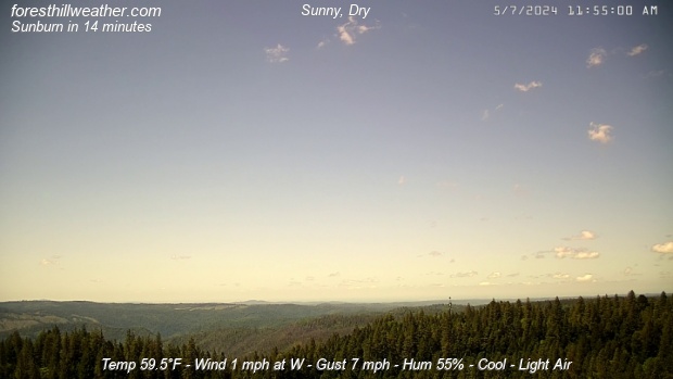
Weather Conditions Overcast, Dry Cloud ht: 300 ft Visibility: 10 miles |
| Todays Rain 0.09 in | |
|
This Icon is a Combination of Blue Canyon Airport and Data From foresthillweather.com |
|
Visibility: 10 miles Cloud ht: 300 ft
ALERT: Geomagnetic K-index of 4
Summary / Temperature ![]()

42.3°F

")
44.9°F

42.6°F 5.9°C
Temp Rate:
24/hr Difference:
Avg Running Temp:
Todays High:
Todays Low:
Y-days High:
Y-days Low:
Todays WChill:
Y-days WChill:
Evapotranspiration:
+0.2°F/hr ![]()
-6.4°F ![]()
44.6°F
46.5°F 12:00am
44.3°F 6:01am
59.8°F 2:54pm
44.6°F 6:26am
37.8°F 7:26am
40.4°F 11:59pm
0.003 in
Pool water Temperature ![]()
Temperature:
Pool Temp VRS Out Temp:
Avg Running Temp:
Todays High:
Todays Low:
Y-days High:
Y-days Low:
59.0°F
+14.1°F ![]()
59.0°F
60.0°F 12:00am
59.0°F 1:56am
61.0°F 7:22pm
59.0°F 12:00am
24hr Pool Temperature Graph 10 day Pool Temperature Graph Wind ![]()

Calm
Gusting to
9.0 mph

184° S

Avg speed:
Wind Run:
Peak Gust:
2.0 mph ![]()
44.0 miles
14 mph 1:45am
Almanac ![]()

Illuminated 17 days in cycle
Moonrise:
Moonset:
Sunrise:
Sunset:
Solar Noon:
11:12pm
7:27am
6:08am
7:49pm
1:01pm
Solar Radiation ![]()
81 W/m2 (12%)
176 W/m2@8:52am

Rain
Rain Today:
Rain Rate (/hr):
Rain last hour:
Rain Yesterday:
This Month:
Season Total:
1 Day Since Last Dry Day
0.09 in
0.000 in
0.00 in
0.38 in
1.79 in
46.22 in
Updated Time
Updated: 4/26/24 9:18am
(Updated sec ago)
Humidity & Barometer
Humidity:
Wetbulb:
Dew Point:
Barometer:
96% ![]()
44.4°F
43.8°F ![]()
29.998 inHg ![]()
| Northern Calif Preparedness |
|
| Fire Level |
|
UV Index ![]()
0.5 Low
0.9 Low
Today Patchy Fog |
Tonight Slight Chance Showers, T-Storms |
Saturday Sunny |
Saturday Night  Mostly Clear |
Sunday Sunny |
Sunday Night  Clear |
| Hi 55 °F ↓ | Lo 42 °F | Hi 61 °F | Lo 45 °F | Hi 65 °F | Lo 46 °F |


Foresthill Probe 2 Stats ![]()
Foresthill Probe 2: is located on Thomas Street
at 3000 feet. The main Foresthill Weather site
is located on Melody ln at the 2860 foot elevation
+0.2°F
98%
| Updated: 26/04/24 - 09:16:02 | |
| Todays High: | 45.9°F 00:00 |
| Todays Low: | 43.5°F 08:01 |
| Rain Today: | 0.10 in |
| Season Total: | 44.15 in |
Foresthill Wx: Monthly,Yearly, Highs and Lows ![]()
|
||||||||||
|
||||||||||
|
||||||||||
|
||||||||||
|
||||||||||
|
||||||||||
|
||||||||||
|
||||||||||
|
||||||||||

")
")
")
")
")
; "Satellite Imagery Sacramento,CA. (click to enlarge)")
| NWS Weather Forecast - Summary | ||||||||||||||||
|
||||||||||||||||
| NWS Weather Forecast: Today and Tonight (Updated: Fri, 26-Apr-2024 5:21am PDT) | |||||
|
|
||||
| NWS Weather Forecast - Summary | ||||||||||||||||
|
||||||||||||||||
| Wunderground Forecast: Today and Tonight | |||||
|
|
||||
| Data Compliments of Weather Underground | |||||
| NOAA Local Storm Report | |||||
| 2 MILES EAST OF Fort Peck ( More ) | |||||
| DATE 04/22/2024 |
TIME 3:46 PM |
COUNTY McCone |
STATE MT |
GEOGRAPHIC 48.01N 106.40W |
SOURCE Mesonet |
| Non-Tstm Wnd Gst MEASURED AT 67 MPH | |||||
| mesonet station ggwfp 2. 4 e fort peck (ggwwfo). *** this is the highest official gust anywhere in ne mt today.***. | |||||
| NOAA Local Storm Report | |||||
| BLM Glendive ( More ) | |||||
| DATE 04/22/2024 |
TIME 2:15 PM |
COUNTY Dawson |
STATE MT |
GEOGRAPHIC 46.92N 104.75W |
SOURCE Mesonet |
| Non-Tstm Wnd Gst MEASURED AT 61 MPH | |||||
| wind wnw 31h61mph. | |||||
| NOAA Local Storm Report | |||||
| 13 MILES NORTH-NORTHEAST OF Nelson Creek Rec ( More ) | |||||
| DATE 04/22/2024 |
TIME 4:00 PM |
COUNTY McCone |
STATE MT |
GEOGRAPHIC 47.74N 106.15W |
SOURCE Mesonet |
| Non-Tstm Wnd Gst MEASURED AT 61 MPH | |||||
| mesonet station mtm87 fort peck s. | |||||
| NOAA Local Storm Report | |||||
| 13 MILES NORTH-NORTHEAST OF Nelson Creek Rec ( More ) | |||||
| DATE 04/22/2024 |
TIME 4:00 PM |
COUNTY McCone |
STATE MT |
GEOGRAPHIC 47.74N 106.15W |
SOURCE Mesonet |
| Non-Tstm Wnd Gst MEASURED AT 61 MPH | |||||
| mesonet station mtm87 fort peck s. | |||||
| NOAA Local Storm Report | |||||
| Bluff Creek ( More ) | |||||
| DATE 04/22/2024 |
TIME 2:44 PM |
COUNTY Valley |
STATE MT |
GEOGRAPHIC 48.87N 106.95W |
SOURCE Mesonet |
| Non-Tstm Wnd Gst MEASURED AT 60 MPH | |||||
| wind wnw 34g60mph. | |||||
| NOAA Local Storm Report | |||||
| 3 MILES EAST-NORTHEAST OF Wolf Point ( More ) | |||||
| DATE 04/22/2024 |
TIME 1:28 PM |
COUNTY Roosevelt |
STATE MT |
GEOGRAPHIC 48.10N 105.58W |
SOURCE ASOS |
| Non-Tstm Wnd Gst MEASURED AT 60 MPH | |||||
| asos station kolf wolf point airport. | |||||
| NOAA Local Storm Report | |||||
| 9 MILES SOUTHWEST OF Bredette ( More ) | |||||
| DATE 04/22/2024 |
TIME 3:30 PM |
COUNTY Roosevelt |
STATE MT |
GEOGRAPHIC 48.43N 105.44W |
SOURCE Mesonet |
| Non-Tstm Wnd Gst MEASURED AT 59 MPH | |||||
| mesonet station mtmcd 8. 5 sw bredette (mt dot). | |||||
| NOAA Local Storm Report | |||||
| Bloomfield ( More ) | |||||
| DATE 04/22/2024 |
TIME 1:46 PM |
COUNTY Dawson |
STATE MT |
GEOGRAPHIC 47.42N 104.96W |
SOURCE Mesonet |
| Non-Tstm Wnd Gst MEASURED AT 58 MPH | |||||
| wind wnw 33g58mph. | |||||
| NOAA Local Storm Report | |||||
| 2 MILES NORTH-NORTHEAST OF Glasgow ( More ) | |||||
| DATE 04/22/2024 |
TIME 2:53 PM |
COUNTY Valley |
STATE MT |
GEOGRAPHIC 48.22N 106.62W |
SOURCE ASOS |
| Non-Tstm Wnd Gst MEASURED AT 58 MPH | |||||
| asos station kggw glasgow airport (asos). | |||||
| NOAA Local Storm Report | |||||
| 1 MILE SOUTH-SOUTHWEST OF Malta ( More ) | |||||
| DATE 04/22/2024 |
TIME 2:40 PM |
COUNTY Phillips |
STATE MT |
GEOGRAPHIC 48.35N 107.88W |
SOURCE Mesonet |
| Non-Tstm Wnd Gst MEASURED AT 58 MPH | |||||
| mesonet station ggwml 0. 9 s malta (ggwwfo). | |||||
| NOAA Local Storm Report | |||||
| 10 MILES SOUTH OF Vida ( More ) | |||||
| DATE 04/22/2024 |
TIME 4:45 PM |
COUNTY McCone |
STATE MT |
GEOGRAPHIC 47.69N 105.50W |
SOURCE Mesonet |
| Tstm Wnd Gst MEASURED AT 58 MPH | |||||
| cow creek mdot. | |||||
| NOAA Local Storm Report | |||||
| Badger Creek ( More ) | |||||
| DATE 04/22/2024 |
TIME 2:00 PM |
COUNTY Richland |
STATE MT |
GEOGRAPHIC 47.95N 104.93W |
SOURCE Mesonet |
| Non-Tstm Wnd Gst MEASURED AT 56 MPH | |||||
| wind w 40g56mph. | |||||
| NOAA Local Storm Report | |||||
| 6 MILES SOUTH OF Comertown ( More ) | |||||
| DATE 04/22/2024 |
TIME 3:15 PM |
COUNTY Sheridan |
STATE MT |
GEOGRAPHIC 48.81N 104.25W |
SOURCE Mesonet |
| Non-Tstm Wnd Gst MEASURED AT 56 MPH | |||||
| mesonet station mtcom 6. 0 s comertown (mt dot). | |||||
| NOAA Local Storm Report | |||||
| GW0525 Bloomfield ( More ) | |||||
| DATE 04/22/2024 |
TIME 12:30 PM |
COUNTY Dawson |
STATE MT |
GEOGRAPHIC 47.42N 104.96W |
SOURCE Mesonet |
| Non-Tstm Wnd Gst MEASURED AT 55 MPH | |||||
| wind w 36g55mph. | |||||
| NOAA Local Storm Report | |||||
| Hays Site ( More ) | |||||
| DATE 04/22/2024 |
TIME 1:45 PM |
COUNTY Phillips |
STATE MT |
GEOGRAPHIC 47.92N 108.73W |
SOURCE Mesonet |
| Non-Tstm Wnd Gst MEASURED AT 55 MPH | |||||
| wind w 27g55mph. | |||||
| NOAA Local Storm Report | |||||
| Lewistown Port #2 ( More ) | |||||
| DATE 04/22/2024 |
TIME 2:15 PM |
COUNTY Phillips |
STATE MT |
GEOGRAPHIC 47.75N 108.73W |
SOURCE Mesonet |
| Non-Tstm Wnd Gst MEASURED AT 55 MPH | |||||
| mesonet station ts705 lewistown port no. 2. | |||||
| NOAA Local Storm Report | |||||
| Malta W ( More ) | |||||
| DATE 04/22/2024 |
TIME 12:15 PM |
COUNTY Phillips |
STATE MT |
GEOGRAPHIC 48.35N 108.00W |
SOURCE Public |
| Non-Tstm Wnd Gst MEASURED AT 54 MPH | |||||
| wind wnw 32g54mph. | |||||
| NOAA Local Storm Report | |||||
| 2 MILES EAST-NORTHEAST OF Plentywood ( More ) | |||||
| DATE 04/22/2024 |
TIME 2:15 PM |
COUNTY Sheridan |
STATE MT |
GEOGRAPHIC 48.78N 104.52W |
SOURCE AWOS |
| Non-Tstm Wnd Gst MEASURED AT 54 MPH | |||||
| awos station kpwd plentywood. | |||||
| NOAA Local Storm Report | |||||
| 2 MILES WEST-SOUTHWEST OF Sidney ( More ) | |||||
| DATE 04/22/2024 |
TIME 2:56 PM |
COUNTY Richland |
STATE MT |
GEOGRAPHIC 47.70N 104.20W |
SOURCE AWOS |
| Non-Tstm Wnd Gst MEASURED AT 54 MPH | |||||
| awos station ksdy sidney airport. | |||||
| NOAA Local Storm Report | |||||
| 1 MILE EAST OF Circle ( More ) | |||||
| DATE 04/22/2024 |
TIME 12:40 PM |
COUNTY McCone |
STATE MT |
GEOGRAPHIC 47.42N 105.57W |
SOURCE AWOS |
| Non-Tstm Wnd Gst MEASURED AT 53 MPH | |||||
| awos station k4u6 1 e circle. | |||||
| NOAA Local Storm Report | |||||
| Cow Creek ( More ) | |||||
| DATE 04/22/2024 |
TIME 12:30 PM |
COUNTY McCone |
STATE MT |
GEOGRAPHIC 47.69N 105.49W |
SOURCE Mesonet |
| Non-Tstm Wnd Gst MEASURED AT 53 MPH | |||||
| wind w 36g53mph. | |||||
| NOAA Local Storm Report | |||||
| McDonalds ( More ) | |||||
| DATE 04/22/2024 |
TIME 12:15 PM |
COUNTY Roosevelt |
STATE MT |
GEOGRAPHIC 48.43N 105.44W |
SOURCE Mesonet |
| Non-Tstm Wnd Gst MEASURED AT 53 MPH | |||||
| winds nw 36g53mph. | |||||
| NOAA Local Storm Report | |||||
| Savage FW8536 ( More ) | |||||
| DATE 04/22/2024 |
TIME 3:00 PM |
COUNTY Richland |
STATE MT |
GEOGRAPHIC 47.53N 104.39W |
SOURCE Mesonet |
| Non-Tstm Wnd Gst MEASURED AT 52 MPH | |||||
| wind wsw 35g52mph. | |||||
| NOAA Local Storm Report | |||||
| Scobey N ( More ) | |||||
| DATE 04/22/2024 |
TIME 1:45 PM |
COUNTY Daniels |
STATE MT |
GEOGRAPHIC 48.88N 105.44W |
SOURCE Mesonet |
| Non-Tstm Wnd Gst MEASURED AT 52 MPH | |||||
| wind wnw 32g52mph. | |||||
| NOAA Local Storm Report | |||||
| King Coulee ( More ) | |||||
| DATE 04/22/2024 |
TIME 1:44 PM |
COUNTY Valley |
STATE MT |
GEOGRAPHIC 47.80N 107.02W |
SOURCE Mesonet |
| Non-Tstm Wnd Gst MEASURED AT 51 MPH | |||||
| mesonet station kigm8 king coulee. | |||||
| NOAA Local Storm Report | |||||
| 3 MILES NORTHWEST OF Richey ( More ) | |||||
| DATE 04/22/2024 |
TIME 3:05 PM |
COUNTY Dawson |
STATE MT |
GEOGRAPHIC 47.67N 105.12W |
SOURCE Mesonet |
| Non-Tstm Wnd Gst MEASURED AT 51 MPH | |||||
| mesonet station dw5890 richey. | |||||
| NOAA Local Storm Report | |||||
| Glasgow West ( More ) | |||||
| DATE 04/22/2024 |
TIME 1:00 PM |
COUNTY Valley |
STATE MT |
GEOGRAPHIC 48.23N 106.72W |
SOURCE Mesonet |
| Non-Tstm Wnd Gst MEASURED AT 50 MPH | |||||
| wind wnw 31g50mph. | |||||
| NOAA Local Storm Report | |||||
| Poplar RAWS ( More ) | |||||
| DATE 04/22/2024 |
TIME 12:18 PM |
COUNTY Roosevelt |
STATE MT |
GEOGRAPHIC 48.13N 105.07W |
SOURCE Mesonet |
| Non-Tstm Wnd Gst MEASURED AT 50 MPH | |||||
| winds w 35g50mph. | |||||
| How Close Are We To this Month's Temperature Record? Updated Friday, Apr 26, 2024- 9:15:01 AM Current Temperature: 44.9°F |
| April's High: Temperature Record 84.0°F - Set on Fri, Apr 28, 2023 - 2:09:11 PM We are currently 39.1°F |
| April's Low: Temperature Record 27.2°F - Set on Mon, Apr 3, 2023 - 7:16:06 AM We are currently 17.7°F |
| Records began on 03 November 2011 |
Weather History April 26, 2024
|


Ambient Weather VWS v14.00 Weather-Display (10.37S-(b58))
Virtual VP software Top Website Map Copyright © 2007 - 2024 Foresthillweather.com Never base important decisions on this or any weather information obtained from the Internet