
- Home
- Forecast
- Radar
- Maps
- WX-Data
- WX-Misc.
- Astronomy
- Fire
- About
- Links
 Air Quality
Space WX Alerts:
( Latest Alert ) - Issue Time: 2024 Apr 26 2300 UTC
39.7°F
Light air
Updated:
4/27/24 5:05am


")

| Advisories / Alerts |
| Severe Wx Summary! | ||||||||
 |
||||||||
|
||||||||
|
||||||||
 |
||||||||
| Sat, Apr 27, 2024 - 5:01am | ||||||||
|
|
|
|
|
|
Info Links


Tropical Cyclone Activity
Current Conditions - Eastern/Central Pacific Region
|
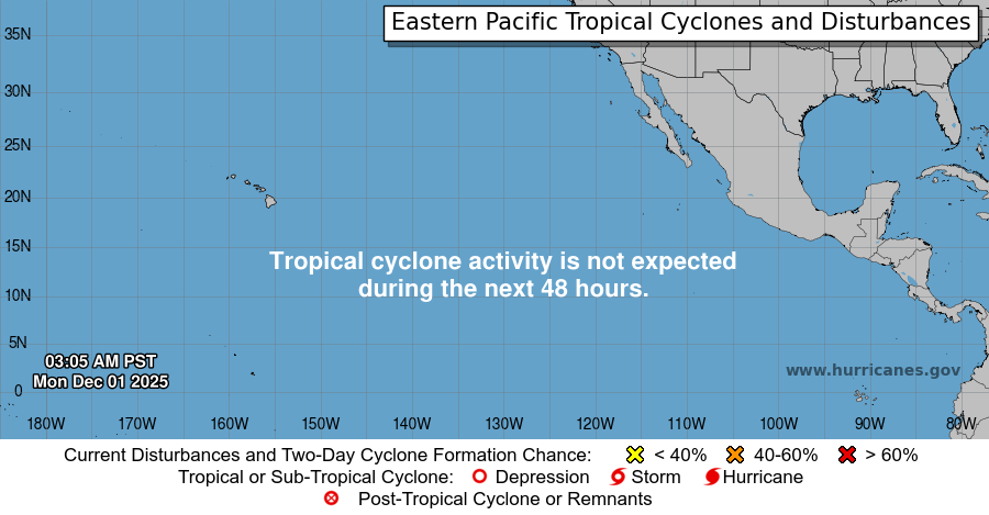
Eastern Pacific Hurricane Season is from May 15 through November 30
Graphical Tropical Weather & 5-Day Outlooks | Central Pacific | Current Conditions
Central Pacific Graphical Tropical Weather Outlook
Central Pacific Hurricane Season is from June 1 through November 30
Central Pacific Data and Image courtesy of Central Pacific Hurricane Center
The Eastern North Pacific hurricane season runs from May 15th through November 30th.
The Eastern North Pacific hurricane season runs from May 15th through November 30th.
Images and Forecasts Courtesy of the National Hurricane Center,
Script by SE Lincoln Weather.


powered by Cumulus v1.9.3 (1059)
Ambient Weather VWS v14.00 Weather-Display (10.37S-(b58))
Virtual VP software Top Website Map Copyright © 2007 - 2024 Foresthillweather.com Never base important decisions on this or any weather information obtained from the Internet
Ambient Weather VWS v14.00 Weather-Display (10.37S-(b58))
Virtual VP software Top Website Map Copyright © 2007 - 2024 Foresthillweather.com Never base important decisions on this or any weather information obtained from the Internet