| Apr 26 9:03 pm PDT |
| IOWA - Clarke COUNTY - 4 MILES SOUTH OF Osceola |
| |
| TORNADO - (Des Moines, IA) |
| |
| Apr 26 7:41 pm PDT |
| IOWA - Jasper COUNTY - Monroe |
| |
| TORNADO - Reports of damage in Monroe. Time estimated from radar. (Des Moines, IA) |
| |
| Apr 26 7:33 pm PDT |
| TEXAS - Bowie COUNTY - 6 MILES EAST-SOUTHEAST OF De Kalb |
| |
| HAIL - 1.00 in - One inch hail was reported in the Malta community. (Shreveport, LO) |
| |
| Apr 26 6:59 pm PDT |
| IOWA - Polk COUNTY - Pleasant Hill |
| |
| TORNADO - Power flashes reported near Pleasant Hill. TDS also noted on radar. (Des Moines, IA) |
| |
| Apr 26 6:56 pm PDT |
| IOWA - Polk COUNTY - 3 MILES SOUTHEAST OF Des Moines |
| |
| TORNADO - Reported by General Public. (Des Moines, IA) |
| |
| Apr 26 6:54 pm PDT |
| IOWA - Polk COUNTY - 4 MILES NORTHWEST OF Pleasant Hill |
| |
| TORNADO - Structure damage to a home with possible injury. (Des Moines, IA) |
| |
| Apr 26 6:52 pm PDT |
| ARKANSAS - Jackson COUNTY - Weldon |
| |
| WIND - Numerous trees and powerlines down in Weldon. Power is also out. (Little Rock, AK) |
| |
| Apr 26 6:38 pm PDT |
| ARKANSAS - Woodruff COUNTY - Augusta |
| |
| WIND - Multiple large tree branches were blown across Highway 64. (Little Rock, AK) |
| |
| Apr 26 6:36 pm PDT |
| IOWA - Clarke COUNTY - Osceola |
| |
| TORNADO - Damage reported near Osceola. Trees and power lines down. Time estimated from radar. (Des Moines, IA) |
| |
| Apr 26 6:36 pm PDT |
| IOWA - Warren COUNTY - 2 MILES NORTHWEST OF Cumming |
| |
| HAIL - 1.00 in - Report from mPING: Quarter (1.00 in.). (Des Moines, IA) |
| |
| Apr 26 6:30 pm PDT |
| TEXAS - Titus COUNTY - 1 MILE SOUTH-SOUTHEAST OF Mount Pleasant |
| |
| HAIL - 1.00 in - (Shreveport, LO) |
| |
| Apr 26 6:29 pm PDT |
| IOWA - Clarke COUNTY - 4 MILES SOUTH OF Osceola |
| |
| TORNADO - Corrects previous tornado report from 4 S Osceola. Time estimated. (Des Moines, IA) |
| |
| Apr 26 6:24 pm PDT |
| TEXAS - Camp COUNTY - 3 MILES NORTH-NORTHEAST OF Rocky Mound |
| |
| HAIL - 1.75 in - Golfball sized hail reported near the dam of Lake Bob Sandlin. (Shreveport, LO) |
| |
| Apr 26 6:19 pm PDT |
| IOWA - Madison COUNTY - 4 MILES WEST OF Cumming |
| |
| TORNADO - Tornadic debris signature noted on radar. (Des Moines, IA) |
| |
| Apr 26 6:18 pm PDT |
| IOWA - Madison COUNTY - 2 MILES SOUTH OF Patterson |
| |
| TORNADO - Reported to the south of Patterson. (Des Moines, IA) |
| |
| Apr 26 6:15 pm PDT |
| IOWA - Union COUNTY - 2 MILES NORTH OF Lorimor |
| |
| WIND - 73 mph - Time estimated from radar. Measured by personal weather station. (Des Moines, IA) |
| |
| Apr 26 6:15 pm PDT |
| IOWA - Madison COUNTY - 2 MILES NORTHEAST OF Patterson |
| |
| TORNADO - Delayed report. Video submitted via social media. Briefly touched down and lifted west of Martensdale. Location estimated from radar. (Des Moines, IA) |
| |
| Apr 26 6:10 pm PDT |
| ARKANSAS - White COUNTY - Searcy |
| |
| WIND - Numerous large trees down in Searcy... powerlines also reported down along with fence damage. (Little Rock, AK) |
| |
| Apr 26 6:03 pm PDT |
| IOWA - Ringgold COUNTY - Mount Ayr |
| |
| HAIL - 3.00 in - (Des Moines, IA) |
| |
| Apr 26 6:03 pm PDT |
| COLORADO - Douglas COUNTY - 1 MILE WEST-NORTHWEST OF Highlands Ranch |
| |
| HAIL - 1.00 in - (Boulder, CO) |
| |
| Apr 26 5:58 pm PDT |
| IOWA - Madison COUNTY - 5 MILES WEST OF East Peru |
| |
| TORNADO - Tornado near Word of Life Church. (Des Moines, IA) |
| |
| Apr 26 5:55 pm PDT |
| ARKANSAS - White COUNTY - Beebe |
| |
| WIND - Trees down on houses... powerlines blown over and billboards damaged in town. (Little Rock, AK) |
| |
| Apr 26 5:54 pm PDT |
| IOWA - Union COUNTY - 2 MILES WEST OF Afton |
| |
| TORNADO - Large tornado near Afton moving northeast. Debris field reported with damage. (Des Moines, IA) |
| |
| Apr 26 5:48 pm PDT |
| ARKANSAS - Lonoke COUNTY - 1 MILE NORTH OF Austin |
| |
| WIND - Hardwood fence blown over. (Little Rock, AK) |
| |
| Apr 26 5:47 pm PDT |
| IOWA - Ringgold COUNTY - 1 MILE EAST OF Mount Ayr |
| |
| TORNADO - Delayed report. Report of tornado between Mt Ayr and Kellerton. Exact location estimated from radar. (Des Moines, IA) |
| |
| Apr 26 5:45 pm PDT |
| IOWA - Ringgold COUNTY - Mount Ayr |
| |
| HAIL - 3.00 in - Corrects previous hail report from Mount Ayr. (Des Moines, IA) |
| |
| Apr 26 5:45 pm PDT |
| ARKANSAS - Lonoke COUNTY - Cabot |
| |
| WIND - Trees reported down in the Magness Creek area of Cabot. Numerous power outages reported as well. (Little Rock, AK) |
| |
| Apr 26 5:44 pm PDT |
| COLORADO - Douglas COUNTY - 3 MILES SOUTH-SOUTHEAST OF Chatfield Reservo |
| |
| HAIL - 1.00 in - (Boulder, CO) |
| |
| Apr 26 5:31 pm PDT |
| IOWA - Union COUNTY - 2 MILES NORTHWEST OF Afton |
| |
| TORNADO - (Des Moines, IA) |
| |
| Apr 26 5:30 pm PDT |
| ARKANSAS - Faulkner COUNTY - Vilonia |
| |
| WIND - Trees reported blown down in Vilonia. (Little Rock, AK) |
| |
| Apr 26 5:28 pm PDT |
| IOWA - Union COUNTY - 4 MILES WEST-NORTHWEST OF Afton |
| |
| TORNADO - Trained spotter reported tornado on the ground east of Creston. Time and location estimated from radar. (Des Moines, IA) |
| |
| Apr 26 5:28 pm PDT |
| ARKANSAS - Pulaski COUNTY - Autumnbrook |
| |
| WIND - Large tree blown over and resting on a powerline. Numerous people without power. (Little Rock, AK) |
| |
| Apr 26 5:28 pm PDT |
| IOWA - Ringgold COUNTY - 2 MILES SOUTH-SOUTHWEST OF Delphos |
| |
| HAIL - 1.00 in - (Des Moines, IA) |
| |
| Apr 26 5:25 pm PDT |
| IOWA - Union COUNTY - 4 MILES WEST-NORTHWEST OF Afton |
| |
| TORNADO - Power poles with debris on US Highway 34 between Creston and Afton. Highway is closed. (Des Moines, IA) |
| |
| Apr 26 5:25 pm PDT |
| ARKANSAS - Pulaski COUNTY - Gibson |
| |
| WIND - Large tree limbs down in Gibson. Winds estimated to be 60 mph. (Little Rock, AK) |
| |
| Apr 26 5:23 pm PDT |
| MISSOURI - Worth COUNTY - 5 MILES NORTH OF Grant City |
| |
| TORNADO - Tornado developed near Highway E west of U.S. Highway 169... causing minor damage to a residence. Tornado tracked northeastward into Iowa. Time estimated from radar. (Kansas City/Pleasant Hill, MO) |
| |
| Apr 26 5:18 pm PDT |
| ARKANSAS - Pulaski COUNTY - Allendale Manor |
| |
| WIND - 1-inch tree limbs broken; Shingles blown off. (Little Rock, AK) |
| |
| Apr 26 5:15 pm PDT |
| IOWA - Union COUNTY - 6 MILES NORTHEAST OF Creston |
| |
| TORNADO - Tornado reported to the southwest of Macksburg. (Des Moines, IA) |
| |
| Apr 26 5:12 pm PDT |
| MISSOURI - Worth COUNTY - 4 MILES EAST-NORTHEAST OF Sheridan |
| |
| HAIL - 1.75 in - Photo relayed of golf ball size hail in Worth County. Time and location estimated from radar. (Kansas City/Pleasant Hill, MO) |
| |
| Apr 26 5:10 pm PDT |
| IOWA - Adams COUNTY - 3 MILES NORTHEAST OF Lenox |
| |
| TORNADO - near 205th and Highway 25. (Des Moines, IA) |
| |
| Apr 26 5:09 pm PDT |
| IOWA - Union COUNTY - Creston |
| |
| TORNADO - Tornado with debris near the hospital in Creston. (Des Moines, IA) |
| |
| Apr 26 5:04 pm PDT |
| IOWA - Union COUNTY - 2 MILES WEST-SOUTHWEST OF Creston |
| |
| TORNADO - Tornado on the ground... heading northeast. (Des Moines, IA) |
| |
| Apr 26 5:00 pm PDT |
| ARKANSAS - Saline COUNTY - Benton |
| |
| WIND - Large tree and numerous powerlines are down on Highway 35 South. A tree was also on fire. (Little Rock, AK) |
| |
| Apr 26 4:58 pm PDT |
| IOWA - Crawford COUNTY - 2 MILES WEST OF Manilla |
| |
| TORNADO - Storm chaser shared a picture of a tornado just west of Manilla. (Des Moines, IA) |
| |
| Apr 26 4:53 pm PDT |
| MISSOURI - Bates COUNTY - 6 MILES SOUTHWEST OF Montrose |
| |
| TORNADO - Downed trees blocking Highway 52 west of Appleton City near the St. Clair County line. Time estimated from radar. (Kansas City/Pleasant Hill, MO) |
| |
| Apr 26 4:53 pm PDT |
| MISSOURI - Bates COUNTY - 7 MILES SOUTHWEST OF Montrose |
| |
| TORNADO - Damage to a structure near Appleton City Lake. Time estimated from radar. (Kansas City/Pleasant Hill, MO) |
| |
| Apr 26 4:49 pm PDT |
| ARKANSAS - Hot Spring COUNTY - Malvern |
| |
| WIND - Large tree blown on top of a car causing considerable damage to the vehicle. (Little Rock, AK) |
| |
| Apr 26 4:36 pm PDT |
| MISSOURI - Bates COUNTY - 8 MILES EAST-NORTHEAST OF Rich Hill |
| |
| TORNADO - Fire department reported a tornado east of Rich Hill. Time and location estimated from radar. (Kansas City/Pleasant Hill, MO) |
| |
| Apr 26 4:30 pm PDT |
| TEXAS - Bowie COUNTY - Wake Village |
| |
| WIND - Trees and powerlines reported down on the Bowie County side of Texarkana. (Shreveport, LO) |
| |
| Apr 26 4:20 pm PDT |
| TEXAS - Cass COUNTY - Hughes Springs |
| |
| WIND - Trees and power lines down. (Shreveport, LO) |
| |
| Apr 26 4:17 pm PDT |
| IOWA - Shelby COUNTY - 2 MILES EAST OF Westphalia |
| |
| TORNADO - (Omaha, NE) |
| |
| Apr 26 4:16 pm PDT |
| IOWA - Taylor COUNTY - 5 MILES NORTH OF New Market |
| |
| HAIL - 1.00 in - Delayed report. (Des Moines, IA) |
| |
| Apr 26 4:14 pm PDT |
| MISSOURI - Holt COUNTY - 2 MILES SOUTHWEST OF Skidmore |
| |
| TORNADO - Fire dept. reported weak tornado. (Kansas City/Pleasant Hill, MO) |
| |
| Apr 26 4:12 pm PDT |
| KANSAS - Bourbon COUNTY - Fulton |
| |
| HAIL - 1.25 in - (Springfield, MO) |
| |
| Apr 26 4:10 pm PDT |
| TEXAS - Bowie COUNTY - Maud |
| |
| WIND - Several trees downed in and around the city of Maud... Texas. (Shreveport, LO) |
| |
| Apr 26 4:08 pm PDT |
| IOWA - Page COUNTY - 1 MILE SOUTHEAST OF Clarinda |
| |
| HAIL - 1.00 in - (Omaha, NE) |
| |
| Apr 26 4:06 pm PDT |
| IOWA - Shelby COUNTY - 2 MILES WEST OF Harlan |
| |
| TORNADO - Home destroyed. (Omaha, NE) |
| |
| Apr 26 4:05 pm PDT |
| IOWA - Shelby COUNTY - 2 MILES WEST OF Harlan |
| |
| TORNADO - Significant damage between Portsmith and Harlan. Destroyed home... cars flipped. (Omaha, NE) |
| |
| Apr 26 4:05 pm PDT |
| IOWA - Shelby COUNTY - 3 MILES WEST OF Harlan |
| |
| TORNADO - Multi vortex tornado. (Omaha, NE) |
| |
| Apr 26 4:03 pm PDT |
| MISSOURI - Bates COUNTY - Hume |
| |
| HAIL - 1.50 in - Photo of approximately ping pong ball size hail in Hume relayed to NWS employee. Time estimated from radar. (Kansas City/Pleasant Hill, MO) |
| |
| Apr 26 4:01 pm PDT |
| KANSAS - Bourbon COUNTY - 3 MILES NORTHEAST OF Hammond |
| |
| WIND - Large trees down. (Springfield, MO) |
| |
| Apr 26 3:59 pm PDT |
| IOWA - Shelby COUNTY - Tennant |
| |
| TORNADO - (Omaha, NE) |
| |
| Apr 26 3:57 pm PDT |
| IOWA - Shelby COUNTY - 3 MILES SOUTH OF Tennant |
| |
| TORNADO - Multiple destroyed outbuildings and a home that lost a roof. Time estimated from radar. (Omaha, NE) |
| |
| Apr 26 3:50 pm PDT |
| ARKANSAS - Hempstead COUNTY - Hope |
| |
| WIND - Trees and power lines down. (Shreveport, LO) |
| |
| Apr 26 3:50 pm PDT |
| IOWA - Pottawattamie COUNTY - 1 MILE WEST-SOUTHWEST OF Shelby |
| |
| TORNADO - Very large tornado crossing Interstate 80. (Omaha, NE) |
| |
| Apr 26 3:49 pm PDT |
| IOWA - Shelby COUNTY - 1 MILE WEST OF Shelby |
| |
| TORNADO - Multiple houses damaged. (Omaha, NE) |
| |
| Apr 26 3:47 pm PDT |
| IOWA - Pottawattamie COUNTY - 2 MILES EAST-NORTHEAST OF Minden |
| |
| TORNADO - Very large multi vortex tornado. At least 1/3 mile wide. (Omaha, NE) |
| |
| Apr 26 3:45 pm PDT |
| KANSAS - Bourbon COUNTY - 3 MILES SOUTH OF Devon |
| |
| TORNADO - Spotter indicated brief touchdown. (Springfield, MO) |
| |
| Apr 26 3:45 pm PDT |
| IOWA - Pottawattamie COUNTY - 1 MILE NORTHEAST OF Minden |
| |
| TORNADO - Large tornado destroying homes. (Omaha, NE) |
| |
| Apr 26 3:41 pm PDT |
| IOWA - Harrison COUNTY - 4 MILES EAST-SOUTHEAST OF Logan |
| |
| TORNADO - (Omaha, NE) |
| |
| Apr 26 3:41 pm PDT |
| IOWA - Pottawattamie COUNTY - Minden |
| |
| TORNADO - Very large tornado. (Omaha, NE) |
| |
| Apr 26 3:40 pm PDT |
| OKLAHOMA - Rogers COUNTY - 1 MILE NORTH OF Chelsea |
| |
| HAIL - 1.50 in - relayed via media...time estimated from radar. (Tulsa, OK) |
| |
| Apr 26 3:40 pm PDT |
| IOWA - Pottawattamie COUNTY - 3 MILES EAST-SOUTHEAST OF Neola |
| |
| TORNADO - (Omaha, NE) |
| |
| Apr 26 3:40 pm PDT |
| TEXAS - Morris COUNTY - 5 MILES SOUTH-SOUTHEAST OF Omaha |
| |
| WIND - Numerous trees down in and around the Rocky Branch community. Traffic stuck on highways because of all the downed trees across roadways. (Shreveport, LO) |
| |
| Apr 26 3:38 pm PDT |
| MISSOURI - Holt COUNTY - 5 MILES EAST-NORTHEAST OF Corning |
| |
| HAIL - 1.00 in - EM reported quarter-sized hail at Hwy 59 and Holt County line. (Kansas City/Pleasant Hill, MO) |
| |
| Apr 26 3:33 pm PDT |
| IOWA - Pottawattamie COUNTY - 2 MILES SOUTHEAST OF Underwood |
| |
| TORNADO - (Omaha, NE) |
| |
| Apr 26 3:30 pm PDT |
| TEXAS - Titus COUNTY - 5 MILES SOUTH OF Mount Pleasant |
| |
| WIND - 63 mph - Measured AWOS wind gust at the Mount Pleasant Airport. (Shreveport, LO) |
| |
| Apr 26 3:30 pm PDT |
| MISSOURI - Atchison COUNTY - 3 MILES NORTH-NORTHWEST OF Corning |
| |
| HAIL - 1.00 in - Social media report of quarter size hail. Time estimated from radar. (Kansas City/Pleasant Hill, MO) |
| |
| Apr 26 3:30 pm PDT |
| ARKANSAS - Pike COUNTY - 5 MILES NORTHWEST OF Pike City |
| |
| WIND - A few trees were blown down in this area. (Little Rock, AK) |
| |
| Apr 26 3:30 pm PDT |
| KANSAS - Bourbon COUNTY - 4 MILES NORTH OF Uniontown |
| |
| HAIL - 1.25 in - (Springfield, MO) |
| |
| Apr 26 3:28 pm PDT |
| IOWA - Pottawattamie COUNTY - 3 MILES SOUTHEAST OF Underwood |
| |
| TORNADO - (Omaha, NE) |
| |
| Apr 26 3:26 pm PDT |
| TEXAS - Titus COUNTY - Mount Pleasant |
| |
| WIND - Numerous trees and powerlines downed in and around the Mount Pleasant area. Three vehicles were impacted by falling trees with rescues ongoing attm. Worst damage was re (Shreveport, LO) |
| |
| Apr 26 3:25 pm PDT |
| TEXAS - Camp COUNTY - Pittsburg |
| |
| WIND - Extensive trees and powerlines downed across the entire county. (Shreveport, LO) |
| |
| Apr 26 3:22 pm PDT |
| TEXAS - Kaufman COUNTY - Grays Prairie |
| |
| WIND - Trees down on CR 4079. (Dallas/Fort Worth, TX) |
| |
| Apr 26 3:20 pm PDT |
| NEBRASKA - Stanton COUNTY - 3 MILES SOUTHEAST OF Norfolk |
| |
| TORNADO - Possible tornado. (Omaha, NE) |
| |
| Apr 26 3:20 pm PDT |
| IOWA - Pottawattamie COUNTY - 7 MILES WEST-NORTHWEST OF Neola |
| |
| TORNADO - (Omaha, NE) |
| |
| Apr 26 3:20 pm PDT |
| NEBRASKA - Stanton COUNTY - 4 MILES SOUTHEAST OF Norfolk |
| |
| WIND - delayed report Roof taken off athletic training center. (Omaha, NE) |
| |
| Apr 26 3:20 pm PDT |
| OKLAHOMA - Rogers COUNTY - 10 MILES NORTH OF Claremore |
| |
| HAIL - 1.00 in - pic from social media... time estimated from radar. (Tulsa, OK) |
| |
| Apr 26 3:18 pm PDT |
| NEBRASKA - Richardson COUNTY - 1 MILE NORTH-NORTHEAST OF Falls City |
| |
| WIND - 58 mph - (Omaha, NE) |
| |
| Apr 26 3:17 pm PDT |
| KANSAS - Allen COUNTY - 4 MILES NORTH OF Elsmore |
| |
| HAIL - 1.25 in - (Wichita, KS) |
| |
| Apr 26 3:14 pm PDT |
| IOWA - Pottawattamie COUNTY - 6 MILES WEST-SOUTHWEST OF Treynor |
| |
| TORNADO - (Omaha, NE) |
| |
| Apr 26 3:13 pm PDT |
| IOWA - Pottawattamie COUNTY - 6 MILES WEST OF Treynor |
| |
| TORNADO - (Omaha, NE) |
| |
| Apr 26 3:09 pm PDT |
| IOWA - Pottawattamie COUNTY - 7 MILES SOUTHEAST OF Council Bluffs |
| |
| TORNADO - (Omaha, NE) |
| |
| Apr 26 3:07 pm PDT |
| IOWA - Pottawattamie COUNTY - 1 MILE SOUTH OF Crescent |
| |
| TORNADO - (Omaha, NE) |
| |
| Apr 26 3:05 pm PDT |
| TEXAS - Franklin COUNTY - 3 MILES NORTH-NORTHEAST OF Winnsboro |
| |
| WIND - Power poles downed across the southern part of Franklin County... Texas. (Shreveport, LO) |
| |
| Apr 26 3:05 pm PDT |
| TEXAS - Franklin COUNTY - 5 MILES NORTH-NORTHEAST OF Winnsboro |
| |
| WIND - Trees downed on two structures between Mount Vernon and Winnsboro. (Shreveport, LO) |
| |
| Apr 26 3:05 pm PDT |
| IOWA - Monona COUNTY - 3 MILES NORTH-NORTHEAST OF Pisgah |
| |
| TORNADO - (Omaha, NE) |
| |
| Apr 26 3:02 pm PDT |
| NEBRASKA - Nemaha COUNTY - Nemaha |
| |
| HAIL - 2.75 in - (Omaha, NE) |
| |
| Apr 26 3:02 pm PDT |
| KANSAS - Allen COUNTY - 8 MILES EAST OF Humboldt |
| |
| TORNADO - Storm chaser video showed brief tornado. (Wichita, KS) |
| |
| Apr 26 3:01 pm PDT |
| IOWA - Pottawattamie COUNTY - 3 MILES EAST-NORTHEAST OF Carter Lake |
| |
| TORNADO - (Omaha, NE) |
| |
| Apr 26 2:57 pm PDT |
| IOWA - Mills COUNTY - 2 MILES NORTH-NORTHWEST OF Pacific Junction |
| |
| TORNADO - (Omaha, NE) |
| |
| Apr 26 2:56 pm PDT |
| NEBRASKA - Sarpy COUNTY - 1 MILE EAST-NORTHEAST OF Papillion |
| |
| HAIL - 1.00 in - (Omaha, NE) |
| |
| Apr 26 2:56 pm PDT |
| NEBRASKA - Douglas COUNTY - 4 MILES EAST OF Omaha |
| |
| TORNADO - (Omaha, NE) |
| |
| Apr 26 2:55 pm PDT |
| NEBRASKA - Douglas COUNTY - 1 MILE NORTHWEST OF Carter Lake |
| |
| HAIL - 1.75 in - (Omaha, NE) |
| |
| Apr 26 2:55 pm PDT |
| TEXAS - Van Zandt COUNTY - 1 MILE NORTH-NORTHWEST OF Canton |
| |
| HAIL - 1.00 in - Quarter sized hail near SH 64 at FM 859. (Dallas/Fort Worth, TX) |
| |
| Apr 26 2:55 pm PDT |
| NEBRASKA - Douglas COUNTY - 5 MILES NORTHEAST OF Omaha |
| |
| HAIL - 1.75 in - (Omaha, NE) |
| |
| Apr 26 2:55 pm PDT |
| NEBRASKA - Douglas COUNTY - 1 MILE NORTH-NORTHEAST OF Omaha |
| |
| HAIL - 1.00 in - (Omaha, NE) |
| |
| Apr 26 2:55 pm PDT |
| IOWA - Pottawattamie COUNTY - Carter Lake |
| |
| HAIL - 1.75 in - (Omaha, NE) |
| |
| Apr 26 2:51 pm PDT |
| TEXAS - San Saba COUNTY - 5 MILES NORTHEAST OF Chappel |
| |
| HAIL - 1.00 in - Quarter size hail in Bend. Time estimated by radar. (San Angelo, TX) |
| |
| Apr 26 2:51 pm PDT |
| TEXAS - Van Zandt COUNTY - 1 MILE NORTH-NORTHWEST OF Canton |
| |
| WIND - Tree down with approximately a 12 inch trunk near SH 64 and FM 859. (Dallas/Fort Worth, TX) |
| |
| Apr 26 2:47 pm PDT |
| NEBRASKA - Sarpy COUNTY - 1 MILE SOUTHWEST OF Papillion |
| |
| HAIL - 1.50 in - (Omaha, NE) |
| |
| Apr 26 2:46 pm PDT |
| NEBRASKA - Washington COUNTY - 3 MILES WEST OF Blair |
| |
| HAIL - 1.00 in - Report from mPING: Quarter (1.00 in.). (Omaha, NE) |
| |
| Apr 26 2:45 pm PDT |
| TEXAS - Wood COUNTY - Yantis |
| |
| WIND - Trees down on multiple county roads in and around the Yantis community. (Shreveport, LO) |
| |
| Apr 26 2:45 pm PDT |
| NEBRASKA - Sarpy COUNTY - Papillion |
| |
| HAIL - 2.00 in - (Omaha, NE) |
| |
| Apr 26 2:43 pm PDT |
| NEBRASKA - Sarpy COUNTY - 2 MILES WEST OF Papillion |
| |
| HAIL - 1.75 in - Report from mPING: Golf Ball (1.75 in.). (Omaha, NE) |
| |
| Apr 26 2:42 pm PDT |
| NEBRASKA - Sarpy COUNTY - 3 MILES NORTHEAST OF Cedar Creek |
| |
| HAIL - 1.75 in - Report from mPING: Golf Ball (1.75 in.). (Omaha, NE) |
| |
| Apr 26 2:40 pm PDT |
| NEBRASKA - Douglas COUNTY - 1 MILE WEST-NORTHWEST OF Ralston |
| |
| HAIL - 1.00 in - (Omaha, NE) |
| |
| Apr 26 2:40 pm PDT |
| NEBRASKA - Sarpy COUNTY - 2 MILES SOUTH-SOUTHWEST OF Papillion |
| |
| HAIL - 1.00 in - (Omaha, NE) |
| |
| Apr 26 2:35 pm PDT |
| IOWA - Harrison COUNTY - Modale |
| |
| TORNADO - Tornado near Modale looks like it roped out. (Omaha, NE) |
| |
| Apr 26 2:32 pm PDT |
| OKLAHOMA - Tulsa COUNTY - 4 MILES SOUTHWEST OF Vera |
| |
| HAIL - 1.00 in - Report from mPING: Quarter (1.00 in.). (Tulsa, OK) |
| |
| Apr 26 2:30 pm PDT |
| NEBRASKA - Sarpy COUNTY - 2 MILES WEST-SOUTHWEST OF La Vista |
| |
| HAIL - 1.00 in - (Omaha, NE) |
| |
| Apr 26 2:30 pm PDT |
| OKLAHOMA - Tulsa COUNTY - 1 MILE EAST OF Skiatook |
| |
| HAIL - 1.00 in - Hail slightly larger than a quarter shown on air. (Tulsa, OK) |
| |
| Apr 26 2:28 pm PDT |
| OKLAHOMA - Tulsa COUNTY - 1 MILE SOUTH OF Skiatook |
| |
| HAIL - 1.50 in - pic larger than quarter shown on air...time estimated from radar. (Tulsa, OK) |
| |
| Apr 26 2:26 pm PDT |
| NEBRASKA - Washington COUNTY - 5 MILES WEST OF Washington |
| |
| HAIL - 1.00 in - Report from mPING: Quarter (1.00 in.). (Omaha, NE) |
| |
| Apr 26 2:25 pm PDT |
| NEBRASKA - Douglas COUNTY - 1 MILE WEST-NORTHWEST OF Valley |
| |
| HAIL - 1.00 in - (Omaha, NE) |
| |
| Apr 26 2:25 pm PDT |
| TEXAS - Kaufman COUNTY - 4 MILES NORTH-NORTHEAST OF Kemp |
| |
| WIND - Reports of several trees down near Becker... including one that fell on a house. A construction light was also blown over. Time estimated from radar. (Dallas/Fort Worth, TX) |
| |
| Apr 26 2:23 pm PDT |
| NEBRASKA - Platte COUNTY - 2 MILES SOUTHEAST OF Creston |
| |
| TORNADO - Multiple vortex tornado. (Omaha, NE) |
| |
| Apr 26 2:20 pm PDT |
| IOWA - Harrison COUNTY - 5 MILES SOUTH-SOUTHWEST OF Modale |
| |
| TORNADO - (Omaha, NE) |
| |
| Apr 26 2:20 pm PDT |
| TEXAS - Kaufman COUNTY - 4 MILES NORTH-NORTHWEST OF Kemp |
| |
| WIND - 75 mph - Gust measured by home weather station. Damage to trees on property. Chicken coop blown away. Time estimated from radar. (Dallas/Fort Worth, TX) |
| |
| Apr 26 2:18 pm PDT |
| NEBRASKA - Washington COUNTY - 4 MILES SOUTHEAST OF Blair |
| |
| TORNADO - (Omaha, NE) |
| |
| Apr 26 2:16 pm PDT |
| NEBRASKA - Platte COUNTY - 1 MILE SOUTH-SOUTHEAST OF Creston |
| |
| TORNADO - Tornado on the ground south on 18th ave. (Omaha, NE) |
| |
| Apr 26 2:12 pm PDT |
| OKLAHOMA - Tulsa COUNTY - 3 MILES EAST OF Mannford |
| |
| HAIL - 1.25 in - pic from news media... time estimated via radar. (Tulsa, OK) |
| |
| Apr 26 2:12 pm PDT |
| NEBRASKA - Washington COUNTY - Blair |
| |
| HAIL - 1.75 in - Report from mPING: Golf Ball (1.75 in.). (Omaha, NE) |
| |
| Apr 26 2:11 pm PDT |
| KANSAS - Nemaha COUNTY - 3 MILES EAST OF Baileyville |
| |
| HAIL - 1.75 in - Emergency Manager reported golf ball size hail. (Topeka, KS) |
| |
| Apr 26 2:10 pm PDT |
| NEBRASKA - Washington COUNTY - 4 MILES SOUTH-SOUTHEAST OF Blair |
| |
| TORNADO - (Omaha, NE) |
| |
| Apr 26 2:10 pm PDT |
| KANSAS - Nemaha COUNTY - Baileyville |
| |
| HAIL - 1.50 in - (Topeka, KS) |
| |
| Apr 26 2:08 pm PDT |
| NEBRASKA - Washington COUNTY - Blair |
| |
| HAIL - 1.25 in - (Omaha, NE) |
| |
| Apr 26 2:08 pm PDT |
| NEBRASKA - Washington COUNTY - 4 MILES EAST OF Kennard |
| |
| TORNADO - Destroyed homes. (Omaha, NE) |
| |
| Apr 26 2:05 pm PDT |
| NEBRASKA - Washington COUNTY - 2 MILES SOUTHEAST OF Kennard |
| |
| TORNADO - Homes damaged. (Omaha, NE) |
| |
| Apr 26 2:00 pm PDT |
| KANSAS - Wilson COUNTY - 1 MILE WEST OF New Albany |
| |
| HAIL - 1.00 in - (Wichita, KS) |
| |
| Apr 26 2:00 pm PDT |
| NEBRASKA - Douglas COUNTY - 2 MILES WEST-SOUTHWEST OF Bennington |
| |
| TORNADO - Multiple homes destroyed. (Omaha, NE) |
| |
| Apr 26 1:59 pm PDT |
| NEBRASKA - Douglas COUNTY - 2 MILES NORTH-NORTHWEST OF Bennington |
| |
| TORNADO - (Omaha, NE) |
| |
| Apr 26 1:55 pm PDT |
| NEBRASKA - Douglas COUNTY - 2 MILES WEST-SOUTHWEST OF Bennington |
| |
| TORNADO - Major structural damage to at least 10 homes. (Omaha, NE) |
| |
| Apr 26 1:52 pm PDT |
| KANSAS - Woodson COUNTY - 4 MILES SOUTH-SOUTHWEST OF Yates Center |
| |
| TORNADO - (Wichita, KS) |
| |
| Apr 26 1:52 pm PDT |
| NEBRASKA - Douglas COUNTY - 3 MILES NORTH OF Elkhorn |
| |
| TORNADO - Very large tornado near Flanagan Lake. (Omaha, NE) |
| |
| Apr 26 1:50 pm PDT |
| NEBRASKA - Boone COUNTY - 4 MILES WEST OF Newman Grove |
| |
| TORNADO - Tornado moving east. (Omaha, NE) |
| |
| Apr 26 1:49 pm PDT |
| NEBRASKA - Douglas COUNTY - 3 MILES NORTH OF Elkhorn |
| |
| TORNADO - Very large tornado near 204th and Ida. (Omaha, NE) |
| |
| Apr 26 1:47 pm PDT |
| NEBRASKA - Boone COUNTY - 5 MILES WEST OF Newman Grove |
| |
| TORNADO - Emergency Manager reported confirmed large tornado 4 to 5 miles west of Newman Grove. (Omaha, NE) |
| |
| Apr 26 1:47 pm PDT |
| NEBRASKA - Douglas COUNTY - 1 MILE NORTH-NORTHWEST OF Elkhorn |
| |
| TORNADO - Very large tornado moving through western Elkhorn. (Omaha, NE) |
| |
| Apr 26 1:45 pm PDT |
| NEBRASKA - Douglas COUNTY - 1 MILE NORTHWEST OF Elkhorn |
| |
| TORNADO - Very large tornado moving into western Elkhorn. (Omaha, NE) |
| |
| Apr 26 1:43 pm PDT |
| KANSAS - Wilson COUNTY - 3 MILES SOUTH OF New Albany |
| |
| TORNADO - Video confirmation of a tornado. (Wichita, KS) |
| |
| Apr 26 1:42 pm PDT |
| KANSAS - Woodson COUNTY - 4 MILES NORTH OF Coyville |
| |
| TORNADO - storm chaser report. (Wichita, KS) |
| |
| Apr 26 1:41 pm PDT |
| KANSAS - Elk COUNTY - 1 MILE WEST OF New Albany |
| |
| HAIL - 1.00 in - May have had a wall cloud initially. (Wichita, KS) |
| |
| Apr 26 1:40 pm PDT |
| NEBRASKA - Douglas COUNTY - 4 MILES SOUTH-SOUTHWEST OF Waterloo |
| |
| TORNADO - 240th and Dodge. (Omaha, NE) |
| |
| Apr 26 1:39 pm PDT |
| NEBRASKA - Douglas COUNTY - 1 MILE NORTH OF Elkhorn |
| |
| TORNADO - House with severe roof damage. (Omaha, NE) |
| |
| Apr 26 1:37 pm PDT |
| NEBRASKA - Douglas COUNTY - 2 MILES SOUTH OF Waterloo |
| |
| TORNADO - Vehicle and building damage. (Omaha, NE) |
| |
| Apr 26 1:36 pm PDT |
| NEBRASKA - Douglas COUNTY - 5 MILES EAST-SOUTHEAST OF Yutan |
| |
| TORNADO - (Omaha, NE) |
| |
| Apr 26 1:33 pm PDT |
| NEBRASKA - Douglas COUNTY - 1 MILE WEST-NORTHWEST OF Valley |
| |
| HAIL - 1.00 in - (Omaha, NE) |
| |
| Apr 26 1:31 pm PDT |
| SOUTH DAKOTA - Lake COUNTY - 5 MILES SOUTHWEST OF Ramona |
| |
| HAIL - 1.00 in - Mostly pea to dime sized hail... but a few as big as a quarter. No damage to anything... since crops are not up yet. (Sioux Falls, SD) |
| |
| Apr 26 1:30 pm PDT |
| NEBRASKA - Douglas COUNTY - 5 MILES EAST-SOUTHEAST OF Yutan |
| |
| TORNADO - (Omaha, NE) |
| |
| Apr 26 1:29 pm PDT |
| NEBRASKA - Platte COUNTY - 5 MILES SOUTH OF Lindsay |
| |
| TORNADO - Emergency manager reported a tornado on the ground 4 to 5 miles south of Lindsay. (Omaha, NE) |
| |
| Apr 26 1:25 pm PDT |
| NEBRASKA - Saunders COUNTY - 5 MILES SOUTHEAST OF Yutan |
| |
| TORNADO - (Omaha, NE) |
| |
| Apr 26 1:15 pm PDT |
| NEBRASKA - Lancaster COUNTY - 4 MILES NORTH-NORTHWEST OF Greenwood |
| |
| TORNADO - EM relayed report from 911 call center of confirmed tornado to the west of Ashland... Nebraska. (Omaha, NE) |
| |
| Apr 26 1:12 pm PDT |
| KANSAS - Greenwood COUNTY - 3 MILES NORTHWEST OF Fall River |
| |
| HAIL - 1.50 in - (Wichita, KS) |
| |
| Apr 26 1:07 pm PDT |
| NEBRASKA - Butler COUNTY - 3 MILES WEST-SOUTHWEST OF Brainard |
| |
| TORNADO - Trained spotter reported a tornado just southwest of Brainard... Nebraska. Tornado has since lifted but there are two additional funnel clouds currently. (Omaha, NE) |
| |
| Apr 26 1:06 pm PDT |
| NEBRASKA - Boone COUNTY - 2 MILES WEST-NORTHWEST OF Saint Edward |
| |
| TORNADO - Small rope tornado. (Omaha, NE) |
| |
| Apr 26 1:05 pm PDT |
| NEBRASKA - Butler COUNTY - 4 MILES WEST-NORTHWEST OF Brainard |
| |
| TORNADO - (Omaha, NE) |
| |
| Apr 26 1:05 pm PDT |
| NEBRASKA - Nance COUNTY - 4 MILES NORTH OF Genoa |
| |
| HAIL - 1.00 in - Report on Facebook of Quarter sized hail north of Genoa. (Hastings, NE) |
| |
| Apr 26 1:03 pm PDT |
| KANSAS - Elk COUNTY - 4 MILES WEST OF Moline |
| |
| HAIL - 1.50 in - (Wichita, KS) |
| |
| Apr 26 1:01 pm PDT |
| KANSAS - Greenwood COUNTY - 2 MILES NORTHWEST OF Severy |
| |
| HAIL - 1.00 in - (Wichita, KS) |
| |
| Apr 26 1:00 pm PDT |
| NEBRASKA - Butler COUNTY - 4 MILES SOUTH-SOUTHEAST OF Garrison |
| |
| TORNADO - Social media photo of confirmed tornado 9 miles south of David City... Nebraska. (Omaha, NE) |
| |
| Apr 26 12:59 pm PDT |
| NEBRASKA - Lancaster COUNTY - 2 MILES WEST-NORTHWEST OF Waverly |
| |
| TORNADO - (Omaha, NE) |
| |
| Apr 26 12:57 pm PDT |
| NEBRASKA - Lancaster COUNTY - 4 MILES SOUTHWEST OF Waverly |
| |
| TORNADO - Train derailment Hwy 6. Additional train derailment Hwy 6 and I-480. Semi-rolled over. (Omaha, NE) |
| |
| Apr 26 12:55 pm PDT |
| NEBRASKA - Lancaster COUNTY - 1 MILE NORTHEAST OF Waverly |
| |
| WIND - Numerous reports of damage near Waverly... including trains blown off tracks... semis overturned. (Omaha, NE) |
| |
| Apr 26 12:55 pm PDT |
| NEBRASKA - Lancaster COUNTY - 4 MILES SOUTHWEST OF Waverly |
| |
| WIND - Building collapsed with people inside. Potential gas leak. (Omaha, NE) |
| |
| Apr 26 12:54 pm PDT |
| NEBRASKA - Lancaster COUNTY - 3 MILES EAST OF Davey |
| |
| HAIL - 2.50 in - delayed report time estimated by radar. (Omaha, NE) |
| |
| Apr 26 12:54 pm PDT |
| NEBRASKA - Butler COUNTY - 5 MILES WEST OF Dwight |
| |
| TORNADO - Relayed from emergency management. (Omaha, NE) |
| |
| Apr 26 12:53 pm PDT |
| NEBRASKA - Lancaster COUNTY - 1 MILE NORTHWEST OF Waverly |
| |
| TORNADO - House damaged. (Omaha, NE) |
| |
| Apr 26 12:51 pm PDT |
| NEBRASKA - Lancaster COUNTY - 4 MILES SOUTHWEST OF Waverly |
| |
| TORNADO - Building collapse. (Omaha, NE) |
| |
| Apr 26 12:51 pm PDT |
| KANSAS - Elk COUNTY - 2 MILES NORTH OF Howard |
| |
| HAIL - 1.00 in - (Wichita, KS) |
| |
| Apr 26 12:50 pm PDT |
| NEBRASKA - Lancaster COUNTY - 5 MILES NORTH-NORTHEAST OF Lincoln |
| |
| TORNADO - (Omaha, NE) |
| |
| Apr 26 12:49 pm PDT |
| NEBRASKA - Lancaster COUNTY - 6 MILES SOUTHEAST OF Malcolm |
| |
| HAIL - 1.25 in - (Omaha, NE) |
| |
| Apr 26 12:48 pm PDT |
| NEBRASKA - Lancaster COUNTY - 5 MILES NORTH-NORTHWEST OF Lincoln |
| |
| HAIL - 1.75 in - (Omaha, NE) |
| |
| Apr 26 12:48 pm PDT |
| NEBRASKA - Lancaster COUNTY - 5 MILES NORTHWEST OF Lincoln |
| |
| HAIL - 1.75 in - Report from mPING: Golf Ball (1.75 in.). (Omaha, NE) |
| |
| Apr 26 12:43 pm PDT |
| NEBRASKA - Lancaster COUNTY - 5 MILES NORTHWEST OF Lincoln |
| |
| TORNADO - Brief tornado touchdown near the Kawasaki Plant. (Omaha, NE) |
| |
| Apr 26 12:41 pm PDT |
| NEBRASKA - Lancaster COUNTY - 4 MILES NORTHWEST OF Lincoln |
| |
| HAIL - 1.50 in - (Omaha, NE) |
| |
| Apr 26 12:35 pm PDT |
| NEVADA - Clark COUNTY - 2 MILES NORTHEAST OF Green Valley |
| |
| WIND - Powerline knocked down due to high winds as showers and thunderstorms moved through the Las Vegas Valley. (Las Vegas, NE) |
| |
| Apr 26 12:35 pm PDT |
| NEBRASKA - Butler COUNTY - Ulysses |
| |
| HAIL - 1.75 in - Butler County Emergency Manager reported golf ball sized hail in downtown Ulysses. (Omaha, NE) |
| |
| Apr 26 12:27 pm PDT |
| NEBRASKA - Lancaster COUNTY - 1 MILE SOUTHEAST OF Denton |
| |
| HAIL - 1.00 in - ground covered with hail. (Omaha, NE) |
| |
| Apr 26 12:24 pm PDT |
| NEBRASKA - Lancaster COUNTY - Denton |
| |
| HAIL - 1.00 in - Report of hail ranging from half an inch to an inch in Denton... NE. (Omaha, NE) |
| |
| Apr 26 12:15 pm PDT |
| NEBRASKA - Boone COUNTY - 6 MILES WEST-SOUTHWEST OF Cedar Rapids |
| |
| HAIL - 1.75 in - (Omaha, NE) |
| |
| Apr 26 11:37 am PDT |
| TEXAS - Navarro COUNTY - 7 MILES SOUTH-SOUTHEAST OF Frost |
| |
| TORNADO - Tornado reported near FM 477 near Brushie Prairie in western Navarro Co. (Dallas/Fort Worth, TX) |
| |
| Apr 26 11:30 am PDT |
| NEBRASKA - Jefferson COUNTY - 6 MILES SOUTH OF Western |
| |
| HAIL - 1.00 in - (Omaha, NE) |
| |
| Apr 26 11:14 am PDT |
| NEBRASKA - Howard COUNTY - 2 MILES NORTH-NORTHWEST OF Elba |
| |
| TORNADO - Several reports of confirmed tornado west and north of Elba. Time and location approximate pending damage survey. (Hastings, NE) |
| |
| Apr 26 11:14 am PDT |
| NEBRASKA - Howard COUNTY - 1 MILE NORTH-NORTHWEST OF Elba |
| |
| TORNADO - Emergency management reported power poles down near Highway 11 and Odell Road. (Hastings, NE) |
| |
| Apr 26 10:58 am PDT |
| NEBRASKA - Howard COUNTY - 1 MILE SOUTH OF Farwell |
| |
| TORNADO - Reported by fireman. Moving north/northeast at the time. (Hastings, NE) |
| |
| Apr 26 10:55 am PDT |
| IOWA - O'Brien COUNTY - 5 MILES SOUTH-SOUTHWEST OF Paullina |
| |
| HAIL - 1.00 in - Quarter sized hail and heavy rain. (Sioux Falls, SD) |
| |
| Apr 26 10:54 am PDT |
| TEXAS - Franklin COUNTY - 1 MILE NORTHWEST OF Mount Vernon |
| |
| HAIL - 1.00 in - Corrects previous hail report from 1 NW Mount Vernon. (Shreveport, LO) |
| |
| Apr 26 10:53 am PDT |
| TEXAS - McLennan COUNTY - 4 MILES EAST OF West |
| |
| TORNADO - Tornado pictures and reports from north of Tours to Penelope. (Dallas/Fort Worth, TX) |
| |
| Apr 26 10:47 am PDT |
| IOWA - Cherokee COUNTY - Cleghorn |
| |
| HAIL - 1.00 in - Report and photo via social media. (Sioux Falls, SD) |
| |
| Apr 26 10:38 am PDT |
| NEBRASKA - Sherman COUNTY - Rockville |
| |
| TORNADO - Tornado confirmed with some damage report. Will update pending damage survey. (Hastings, NE) |
| |
| Apr 26 10:30 am PDT |
| IOWA - Cherokee COUNTY - 4 MILES NORTH-NORTHWEST OF Washta |
| |
| HAIL - 1.25 in - Quarter to Half Dollar sized hail reported by the Cherokee County EM. Time matched up to Radar. (Sioux Falls, SD) |
| |
| Apr 26 10:28 am PDT |
| NEBRASKA - Sherman COUNTY - 2 MILES NORTH-NORTHEAST OF Ravenna |
| |
| TORNADO - Location approximate. May be adjusted. Estimated on the ground for 4 to 5 minutes. Video confirmed. (Hastings, NE) |
| |
| Apr 26 10:26 am PDT |
| TEXAS - McLennan COUNTY - 5 MILES SOUTH OF Gholson |
| |
| TORNADO - Tornado pictures and damage reports from the China Springs area. Time estimated. (Dallas/Fort Worth, TX) |
| |
| Apr 26 10:25 am PDT |
| NEBRASKA - Sherman COUNTY - 2 MILES NORTH OF Ravenna |
| |
| HAIL - 1.25 in - Started to cover the ground with quarter to half-dollar size hail. (Hastings, NE) |
| |
| Apr 26 10:19 am PDT |
| TEXAS - Tarrant COUNTY - 2 MILES NORTHEAST OF Arlington |
| |
| HAIL - 1.75 in - Report from mPING: Golf Ball (1.75 in.). (Dallas/Fort Worth, TX) |
| |
| Apr 26 10:11 am PDT |
| TEXAS - Tarrant COUNTY - Arlington |
| |
| HAIL - 1.00 in - Quarter hail reported in Arlington. (Dallas/Fort Worth, TX) |
| |
| Apr 26 10:10 am PDT |
| NEBRASKA - Buffalo COUNTY - Ravenna |
| |
| HAIL - 1.75 in - Also reports of dime to half-dollar size hail in Ravenna. (Hastings, NE) |
| |
| Apr 26 10:10 am PDT |
| TEXAS - Tarrant COUNTY - 2 MILES NORTHEAST OF Kennedale |
| |
| HAIL - 1.75 in - Golf ball hail reported at Little Rd and I20 in SE Fort Worth. (Dallas/Fort Worth, TX) |
| |
| Apr 26 10:09 am PDT |
| TEXAS - Tarrant COUNTY - 2 MILES SOUTHEAST OF Kennedale |
| |
| HAIL - 1.00 in - Report from mPING: Quarter (1.00 in.). (Dallas/Fort Worth, TX) |
| |
| Apr 26 10:03 am PDT |
| TEXAS - Johnson COUNTY - 3 MILES SOUTHEAST OF Burleson |
| |
| HAIL - 1.00 in - Quarter hail reported. (Dallas/Fort Worth, TX) |
| |
| Apr 26 8:10 am PDT |
| TEXAS - San Saba COUNTY - 8 MILES EAST-SOUTHEAST OF Chappel |
| |
| HAIL - 1.25 in - 1.25 inch hail reported at Colorado Bend State Park. (San Angelo, TX) |
| |
| Apr 26 5:51 am PDT |
| OKLAHOMA - Pittsburg COUNTY - 4 MILES NORTH OF Dow |
| |
| WIND - 65 mph - (Tulsa, OK) |
| |
| Apr 26 5:45 am PDT |
| OKLAHOMA - Pittsburg COUNTY - Mcalester |
| |
| WIND - Large trees and power lines down. (Tulsa, OK) |
| |
|
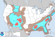
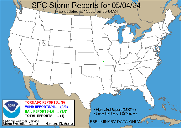
Daily reports from the Storm Prediction Center starts at noon UTC and ends at one minute before noon UTC the next day. This time period is between 5am PDT and one minute before 5am PDT the next day.
All reports are considered preliminary and should be treated as such.
|
|
| Data courtesy of National Weather Service |
| |




 Air Quality


