
- Home
- Forecast
- Radar
- Maps
- WX-Data
- WX-Misc.
- Astronomy
- Fire
- About
- Links
 Air Quality
Radar |
") |
| Advisories / Alerts |
| Severe Wx Summary! | ||||||
 |
||||||
|
||||||
|
||||||
 |
||||||
| Thu, Apr 25, 2024 - 11:51pm | ||||||
|
|
|
|
|
|
| Today's Forecast Map |
| Color Satellite |
| Info Links | |
| Live NOAA Weather Radio |
 |
|
|

| La Niña / El Niño Index |
| Past 48 months graph |
| Past 10 Years graph |
| 1950 to Present graph |
| 1950 to Present Text |
| Synopsis and more |
| Water Temp Map |
|
")
| Free Web Stickers |
| Forecast Search |


|
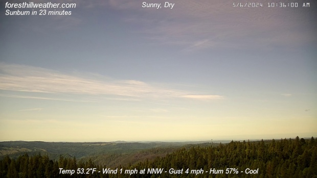
Weather Conditions Overcast , Heavy Rain Cloud ht: 200 ft Visibility: 1/2 mile |
| Todays Rain 0.38 in | |
|
This Icon is a Combination of Blue Canyon Airport and Data From foresthillweather.com |
|
Visibility: 1/2 mile Cloud ht: 200 ft
WARNING: Geomagnetic K-index of 4 expected
Summary / Temperature ![]()

42.5°F

")
43.0°F

46.6°F/ 8.1°C
Temp Rate:
24/hr Difference:
Avg Running Temp:
Todays High:
Todays Low:
Y-days High:
Y-days Low:
Todays WChill:
Y-days WChill:
Evapotranspiration:
-1.0°F/hr ![]()
-2.5°F ![]()
47.2°F
59.8°F 2:54pm
44.6°F 6:26am
56.2°F 12:14pm
45.9°F 5:46am
40.4°F 11:59pm
45.9°F 5:46am
0.100 in
Pool water Temperature ![]()
Temperature:
Pool Temp VRS Out Temp:
Avg Running Temp:
Todays High:
Todays Low:
Y-days High:
Y-days Low:
60.0°F ![]()
+13.5°F ![]()
60.1°F
61.0°F 7:22pm
59.0°F 12:00am
60.0°F 1:22pm
59.0°F 12:00am
24hr Pool Temperature Graph 10 day Pool Temperature Graph Wind ![]()

6.0 mph
Gusting to
14.0 mph

175° S

Avg speed:
Wind Run:
Peak Gust:
5.0 mph ![]()
64.0 miles
18 mph 2:52pm
Almanac ![]()

Illuminated 16 days in cycle
Moonrise:
Moonset:
Sunrise:
Sunset:
Solar Noon:
10:06pm
6:51am
6:09am
7:48pm
1:01pm
Solar Radiation ![]()
Rain
Rain Today:
Rain Rate (/hr):
Rain last hour:
Rain Yesterday:
This Month:
Season Total:
10 Days Since Last Rain Day
0.38 in
0.26 in
0.10 in
0.00 in
1.70 in
46.13 in
Updated Time
Updated: 4/25/24 11:59pm
(Updated sec ago)
Humidity & Barometer
Humidity:
Wetbulb:
Dew Point:
Barometer:
94% ![]()
45.6°F
44.9°F ![]()
30.018 inHg
| Northern Calif Preparedness |
|
| Fire Level |
|
UV Index ![]()
0.0 None
7.8 High
Tonight Showers, |
Friday Showers, |
Friday Night  Mostly Clear |
Saturday Sunny |
Saturday Night  Partly Cloudy |
Sunday Sunny |
| Lo 45 °F | Hi 55 °F ↓ | Lo 42 °F | Hi 63 °F | Lo 46 °F | Hi 66 °F |


Foresthill Probe 2 Stats ![]()
Foresthill Probe 2: is located on Thomas Street
at 3000 feet. The main Foresthill Weather site
is located on Melody ln at the 2860 foot elevation
-1.0°F
97%

| Updated: 25/04/24 - 23:57:47 | |
| Todays High: | 60.2°F 15:04 |
| Todays Low: | 44.1°F 06:29 |
| Rain Today: | 0.44 in |
| Season Total: | 44.04 in |
Foresthill Wx: Monthly,Yearly, Highs and Lows ![]()
|
||||||||||
|
||||||||||
|
||||||||||
|
||||||||||
|
||||||||||
|
||||||||||
|
||||||||||
|
||||||||||
|
||||||||||

")
")
")
")
")
; "Satellite Imagery Sacramento,CA. (click to enlarge)")
| NWS Weather Forecast - Summary | ||||||||||||||||
|
||||||||||||||||
| NWS Weather Forecast: Tonight and Friday (Updated: Thu, 25-Apr-2024 5:21pm PDT) | |||||
|
|
||||
| NWS Weather Forecast - Summary | ||||||||||||||||
|
||||||||||||||||
| Wunderground Forecast: Tonight and Tomorrow | |||||
|
|
||||
| Data Compliments of Weather Underground | |||||
| NOAA Local Storm Report | |||||
| 1 MILE WEST-NORTHWEST OF York ( More ) | |||||
| DATE 04/20/2024 |
TIME 4:03 PM |
COUNTY York |
STATE SC |
GEOGRAPHIC 35.00N 81.25W |
SOURCE NWS Storm Survey |
| Tstm Wnd Gst ESTIMATED AT 90 MPH | |||||
| an intense severe thunderstorm impacted portions of york county on the afternoon of saturday, april 20th. This storm produced a swath of extensive wind damage extending from the city of york to the city of rock hill and continuing to the lancaster county line. Winds within this corridor were estimated to be between 70-90 mph, which downed large numbers of trees and power lines. Structural damage also occurred to a number of residences and businesses including collapsed gas station canopies, roof damage, blown out windows, and facade/siding damage. The storm also produced very large hail ranging from 2-2. 75 inches (hen egg to baseball size). The combination of high winds and very large hail resulted in wind-driven hail that further exacerbated damage to structures, vehicles and trees. | |||||
| How Close Are We To this Month's Temperature Record? Updated Thursday, Apr 25, 2024- 11:55:01 PM Current Temperature: 46.5°F |
| April's High: Temperature Record 84.0°F - Set on Fri, Apr 28, 2023 - 2:09:11 PM We are currently 37.5°F |
| April's Low: Temperature Record 27.2°F - Set on Mon, Apr 3, 2023 - 7:16:06 AM We are currently 19.3°F |
| Records began on 03 November 2011 |
Weather History April 26, 2024
|


Ambient Weather VWS v14.00 Weather-Display (10.37S-(b58))
Virtual VP software Top Website Map Copyright © 2007 - 2024 Foresthillweather.com Never base important decisions on this or any weather information obtained from the Internet